Childrens Pool Reef Exposed at Extreme Low Tide, La Jolla, California. Aerial panoramic photograph.
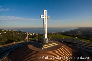
Sunrise over The Mount Soledad Cross, a landmark in La Jolla, California. The Mount Soledad Cross is a 29-foot-tall cross erected in 1954. Aerial photo
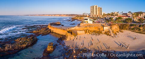
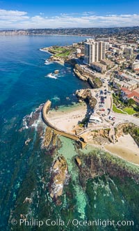
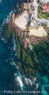
South Casa Cove and Childrens Pool sea wall, with tourist crowds at sunset on a low tide, La Jolla
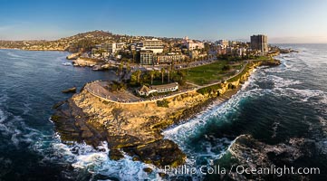
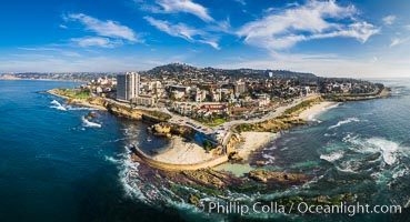
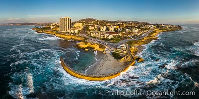
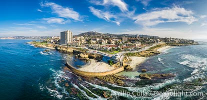
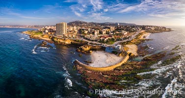
Aerial Panoramic Photo of Point La Jolla at sunset, La Jolla and Mount Soledad. People enjoying the sunset on the sea wall looking at sea lions on the rocks.
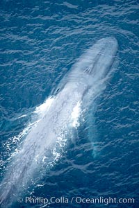
Blue whale (Balaenoptera musculus) surfacing, aerial photo, near La Jolla, California.
Scripps Institute of Oceanography research pier, La Jolla.
Childrens Pool Aerial Panoramic Photo at Sunset, people enjoying the sunset on the sea wall and the protected beach, Coast Boulevard in the foreground, Mount Soledad in the distance
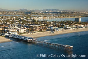
Aerial photo of Crystal Pier, Pacific Beach.
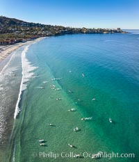
Surfers at La Jolla Shores Beach, aerial photo
Childrens Pool and La Jolla coastline at sunset, aerial panorama, showing underwater reef exposed at King Low Tide
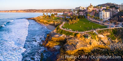
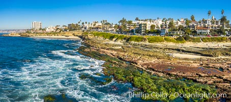
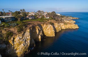
Aerial Photo of Point La Jolla and Scripps Park, La Jolla Coastline
Goldfish Point and La Jolla Caves aerial photograph, La Jolla.
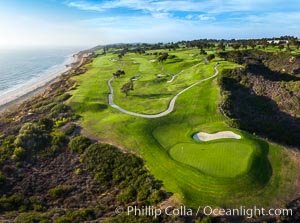
Torrey Pines Golf Course over looking Blacks Beach and the Pacific Ocean, south course, summer, afternoon.
Childrens Pool Reef Exposed at Extreme Low Tide, Aerial View, La Jolla, California. Aerial panoramic photograph.
Aerial Photo of San Diego Scripps Coastal SMCA. Scripps Institution of Oceanography Research Pier.
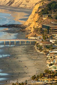
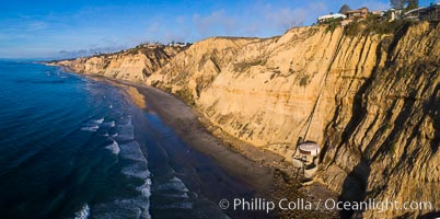
La Jolla Shores Coastline and Scripps Pier, Blacks Beach and Torrey Pines, aerial photo, sunset
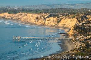
La Jolla Shores Coastline and Scripps Pier, Blacks Beach and Torrey Pines Golf Course and State Reserve, aerial photo, sunset. The Gold Coast of La Jolla basks in the warm waning light of a winter afternoon.
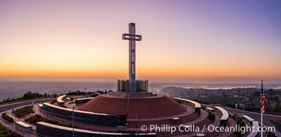
Sunrise over The Mount Soledad Cross, a landmark in La Jolla, California. The Mount Soledad Cross is a 29-foot-tall cross erected in 1954. Aerial photo.
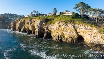
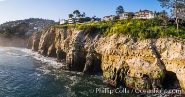
La Jolla Caves and the Coast Walk, La Jolla. Aerial panoramic photograph.
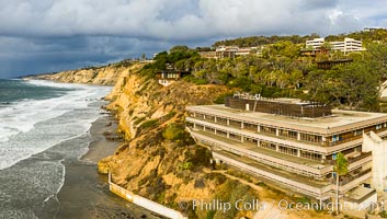
Blacks Beach and Mushroom House, aerial photo
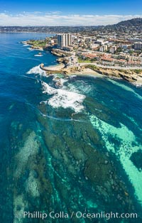
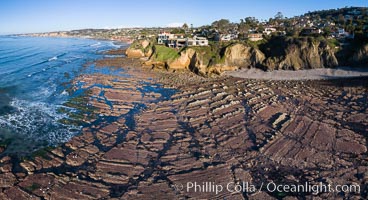
La Jolla Underwater Park visible at Extreme Low Tide, La Jolla, California
Childrens Pool Reef Exposed at Extreme Low King Tide, La Jolla, California. Aerial panoramic photograph.
Scripps Pier and Christmas Lights, La Jolla Coastline, Aerial view
Childrens Pool Reef Exposed at Extreme Low Tide, La Jolla, California. Aerial panoramic photograph.
Childrens Pool Reef Exposed at Extreme Low King Tide, La Jolla, California. Aerial panoramic photograph.
Aerial Panoramic Photo of Children's Pool, Casa Cove and La Jolla Coastline. The underwater reef is exposed by extreme low tide.
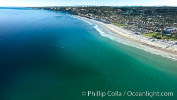
La Jolla Shores Beach and La Jolla Submarine Canyon, aerial photo
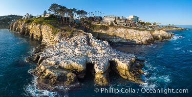
La Jolla Caves and Coastline, Goldfish Point, Aerial Panoramic Photo
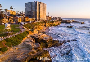
Aerial Photo of Point La Jolla and Scripps Park, La Jolla Coastline
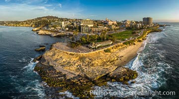
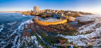
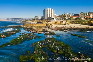
Point La Jolla and Scripps Park aerial photo, sunset, sea lions and sea gulls and tourists looking down on Boomer Beach. Aerial panoramic photo.
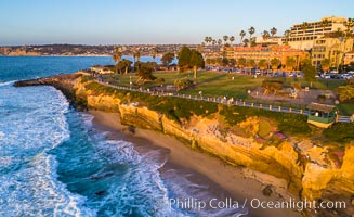
Aerial Photo of Point La Jolla and Scripps Park, La Jolla Coastline
Exposed reef near Windansea, seen during King Low Tide, aerial panoramic photo
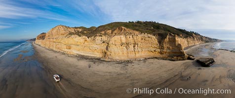
180-degree north-south panorama of Torrey Pines State Reserve seacliffs, with flat rock and Torrey Pines State Beach, photographed with a balloon aerial survey photography rig.
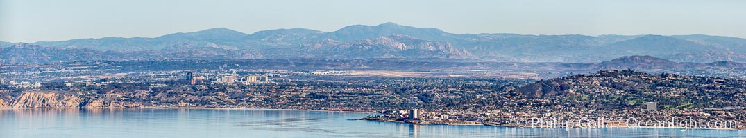
Aerial Panorama of La Jolla, University City, showing (from left) UCSD, University City, Scripps Institution of Oceanography, La Jolla Shores, Point La Jolla, Mount Soledad, in the background some of the mountains to the east of San Diego. The highest peak in the center of the panoram is Cuyamaca Peak (6512') while the rocky peak directly in front of it is El Cajon Mountain (3675').
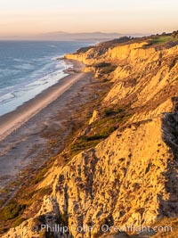
Torrey Pines balloon aerial survey photo. Torrey Pines seacliffs, rising up to 300 feet above the ocean, stretch from Del Mar to La Jolla. On the mesa atop the bluffs are found Torrey pine trees, one of the rare species of pines in the world. Peregine falcons nest at the edge of the cliffs. This photo was made as part of an experimental balloon aerial photographic survey flight over Torrey Pines State Reserve, by permission of Torrey Pines State Reserve.
La Jolla Shores coastline, from Point La Jolla in the south to Blacks Beach in the north, aerial photo

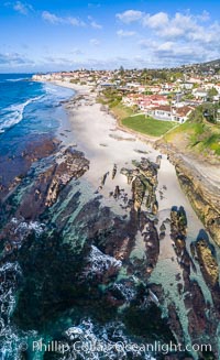
Aerial Panorama of Nicholson Point and Hospitals Beach, aerial photo, extreme low tide, La Jolla, California
Scripps Institution of Oceanography and Blacks Beach Aerial Photo. Torrey Pines State Reserve in the distance.
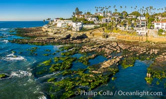
South Casa Reef Exposed at Extreme Low Tide, La Jolla, California
La Jolla Caves and Coastline, Goldfish Point, Aerial Photo
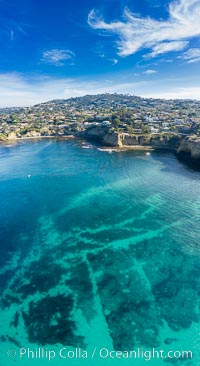
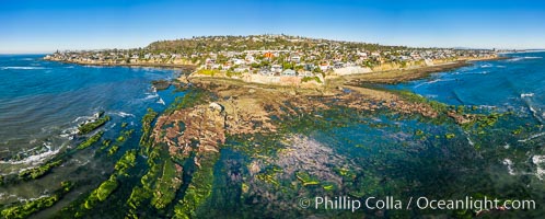
La Jolla Bay submarine reef system on extreme low King Tide, south of La Jolla Shores, aerial panoramic photo
Bird Rock Reef Exposed at Extreme Low Tide, La Jolla, California
Childrens Pool Reef Exposed at Extreme Low King Tide, La Jolla, California. Aerial panoramic photograph.
Sun Gold Point Reef Exposed at Extreme Low Tide, La Jolla, California
Blacks Beach and Torrey Pines sea cliffs, looking north, aerial photo, La Jolla, California
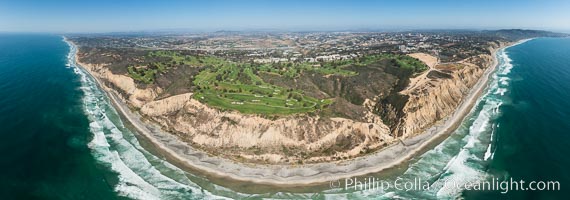
Aerial panorama of Blacks Beach, Torrey Pines Golf Course (south course), and views to La Jolla (south) and Carlsbad (north)
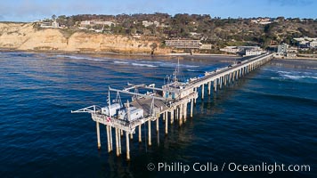
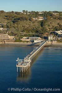
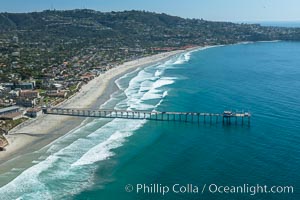
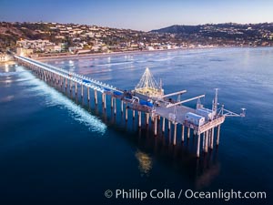
Aerial Photo of Scripps Pier. SIO Pier. The Scripps Institution of Oceanography research pier is 1090 feet long and was built of reinforced concrete in 1988, replacing the original wooden pier built in 1915. The Scripps Pier is home to a variety of sensing equipment above and below water that collects various oceanographic data. The Scripps research diving facility is located at the foot of the pier. Fresh seawater is pumped from the pier to the many tanks and facilities of SIO, including the Birch Aquarium. The Scripps Pier is named in honor of Ellen Browning Scripps, the most significant donor and benefactor of the Institution