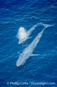
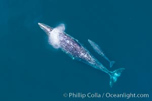
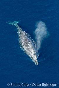
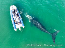
Blue Whale Aerial Photo. Two blue whales, a mother and her calf, swim through the open ocean in this aerial photograph. The calf is blowing (spouting, exhaling) with a powerful column of spray. Balaenoptera musculus.
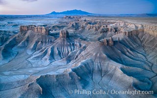
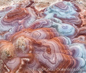
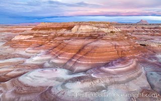
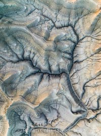
The Tree of Eons, a spectacular dendritic formation in the Bentonic Hills of Utah. Fantastic colorful sedimentary patterns, ancient Bentonite layers are exposed through erosion in the Utah Badlands. The Bentonite Hills are composed of the Brushy Basin shale member of the Morrison Formation. This layer was formed during Jurassic times when mud, silt, fine sand, and volcanic ash were deposited in swamps and lakes. Photographed just before sunrise with soft pre-dawn illumination. Aerial panoramic photograph.
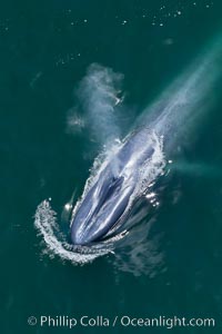
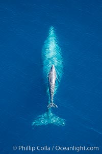
Aerial photo of a blue whale. Blue whale, exhaling as it surfaces from a dive, aerial photo taken off the coast of California.
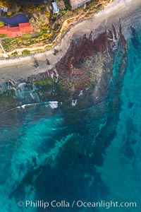
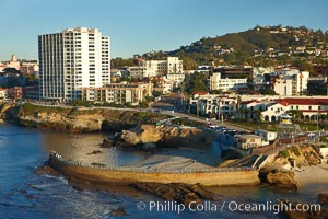
Childrens Pool Reef Exposed at Extreme Low Tide, La Jolla, California. Aerial panoramic photograph.
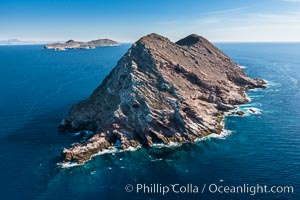
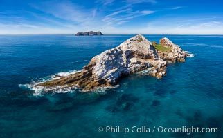
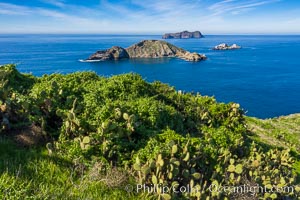
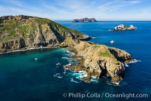
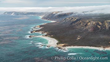
San Clemente Island Pyramid Head, showing geologic terracing, underwater reefs and giant kelp forests
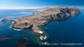
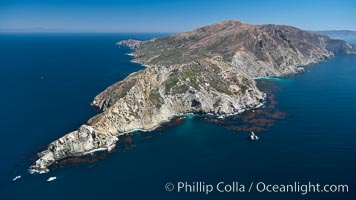
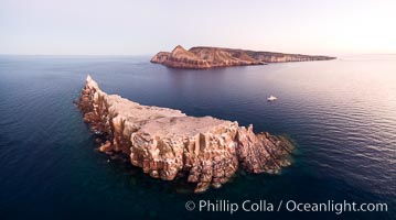
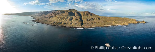
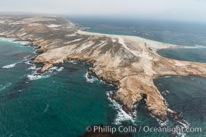
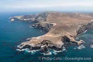
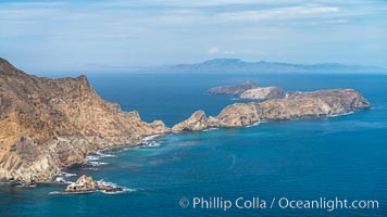
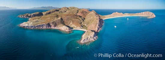
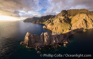
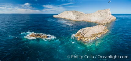
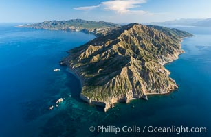
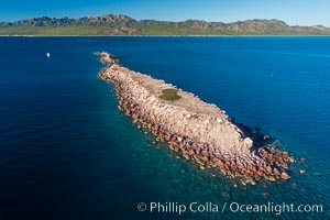
San Clemente Island aerial photo, Pyramid Head and Balanced Rock (China Hat) at the southern end of the island. San Clemente Island Pyramid Head, the distinctive pyramid shaped southern end of the island, exhibits distinctive geologic terracing, underwater reefs and giant kelp forests
Mother and calf southern right whales are seen here as part of a larger courtship group, with adult males interested in mating with the mother. The calf has no choice but to stay by her mother's side during the courting activities.
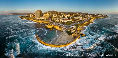
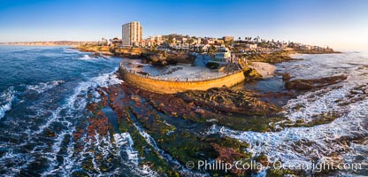
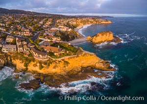
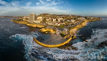
Aerial Panoramic Photo of Point La Jolla at sunset, La Jolla and Mount Soledad. People enjoying the sunset on the sea wall looking at sea lions on the rocks.
South Casa Cove and Childrens Pool sea wall, with tourist crowds at sunset on a low tide, La Jolla
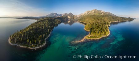
Emerald Bay Lake Tahoe, aerial panoramic photo of the mouth of the bay, early morning
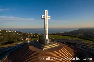
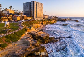
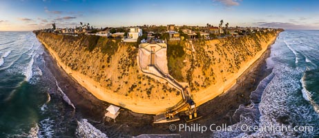
Sunrise over The Mount Soledad Cross, a landmark in La Jolla, California. The Mount Soledad Cross is a 29-foot-tall cross erected in 1954. Aerial photo
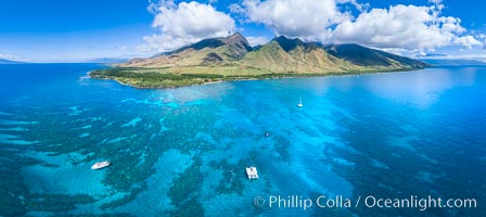
Olowalu reef and West Maui mountains, Maui, Hawaii, aerial photo
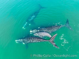
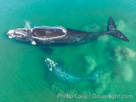
Mother and calf gray whale, aerial photo, embryonic folds visible on the very young calf
Batiquitos Lagoon and Ponto, stormy sunset, aerial panoramic photograph.
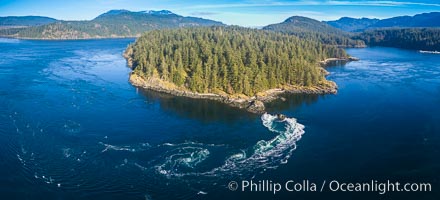
Dive Boat Hurst Island, Browning Pass, Canada, aerial photo
Browning Pass aerial photo, with Nigei Island (left) and Balackava Island (right).
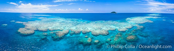
Aerial View of Namena Marine Reserve and Coral Reefs, Namena Island, Fiji
Cabo Pearce on Socorro Island, aerial photo, Revillagigedos Islands, Mexico
Mariner Mountain, Strathcona Provincial Park, Vancouver Island
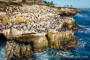
Brown Pelicans gather in large numbers on coastal cliffs, Goldfish Point near the Clam in La Jolla.
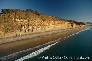
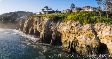
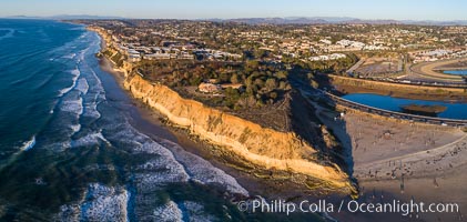
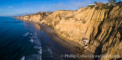
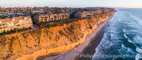
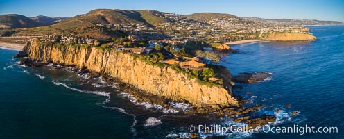
Seacliffs, Torrey Pines State Reserve, La Jolla, aerial photo.
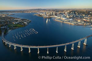
Aerial photo of the San Diego Coronado Bridge, which links San Diego with Coronado Island.
Aerial photo of the West End of Catalina Island
Los Islotes, famous for its friendly colony of California sea lions, part of Archipelago Espiritu Santo, Sea of Cortez, Aerial Photo
Makena Beach State Park aerial photo, Maui, Hawaii. Big Beach on the right, Little Beach on the left, Haleakala rising in the distance on the right, West Maui Mountains in the distance on the left.
Dawn over the Skyline Rim, Factory Bench and Lower Blue Hills, Utah. The Henry Mountains are in the distance.
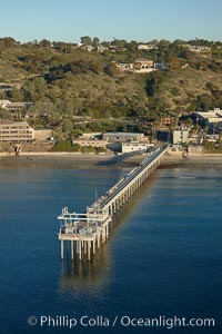
Scripps Institute of Oceanography research pier, La Jolla.
Steller Sea Lions atop Norris Rocks, Hornby Island in the distance, panoramic photo
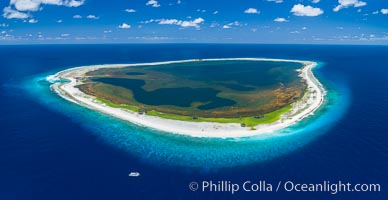
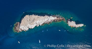
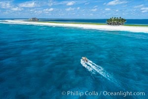
Aerial panorama of Clipperton Island, showing the entire atoll. Clipperton Island, a minor territory of France also known as Ile de la Passion, is a small (2.3 sq mi) but spectacular coral atoll in the eastern Pacific. By permit HC / 1485 / CAB (France)
Los Islotes and Isla Partida, the northern part of Archipelago Espiritu Santo, Sea of Cortez, Aerial Photo. Islotes is famous for its friendly colony of California sea lions.
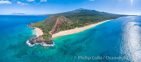
San Clemente Island aerial photo, Pyramid Head and Balanced Rock at the southern end of the island. San Clemente Island Pyramid Head, the distinctive pyramid shaped southern end of the island, exhibits distinctive geologic terracing, underwater reefs and giant kelp forests
Aerial photo of gray whale calf and mother. This baby gray whale was born during the southern migration, far to the north of the Mexican lagoons of Baja California where most gray whale births take place.
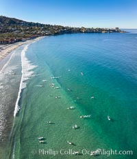
Surfers at La Jolla Shores Beach, aerial photo
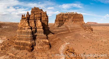
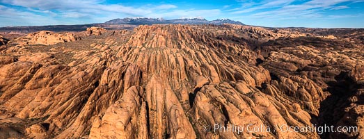
Molly's Castle, aerial view, Goblin Valley State Park. Curtis Formation whiteish caprock is on top, with reddish Entrada Sandstone below, both of Jurassic era. Molly's castle lies in the San Rafael desert near Goblin Valley, and drains into the Colorado River watershed. Aerial panoramic photograph.
Blue whale eating krill, aerial photo, the mouth and throat pleats are engorged with water and krill. Aerial photo, Baja California.
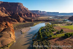
Colorado River and Sorrel River Ranch, Moab, Utah. The Dome Plateau rises over the river on the left.
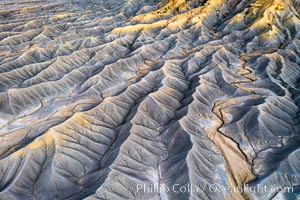
Erosion patterns in the Utah Badlands, aerial abstract photo.
Fantastic colorful sedimentary patterns of Bentonite layers, seen as striations exposed in the Utah Badlands. The Bentonite Hills are composed of the Brushy Basin shale member of the Morrison Formation formed during Jurassic times when mud, silt, fine sand, and volcanic ash were deposited in swamps and lakes into layers, now revealed through erosion. Aerial photograph.
Stone Steps Beach at Sunset, Aerial Panorama, Encinitas, California
Hurst Island and Gods Pocket Provincial Park, aerial photo
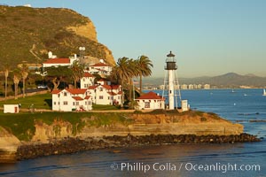
New Point Loma Lighthouse, situated on the tip of Point Loma Peninsula, marks the entrance to San Diego Bay. The lighthouse rises 70' and was built in 1891 to replace the ""old"" Point Loma Lighthouse which was often shrouded in fog.
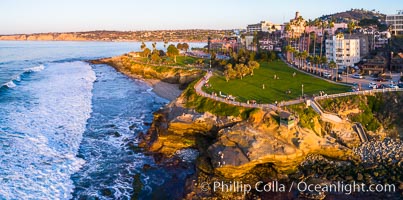
Childrens Pool Aerial Panoramic Photo at Sunset, people enjoying the sunset on the sea wall and the protected beach, Coast Boulevard in the foreground, Mount Soledad in the distance
Aerial View of Namena Island, Fiji
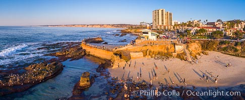
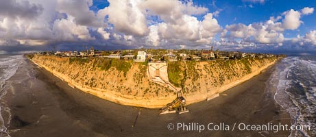
Childrens Pool and La Jolla coastline at sunset, aerial panorama, showing underwater reef exposed at King Low Tide
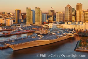
Aerial photo of downtown San Diego and USS Midway aircraft carrier museum.
Self-portrait at dawn, Bentonite Hills, Utah
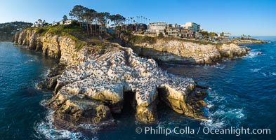
Goldfish Point and La Jolla Caves aerial photograph, La Jolla.
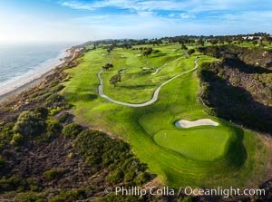
Torrey Pines Golf Course over looking Blacks Beach and the Pacific Ocean, south course, summer, afternoon.
Laguna Beach Coastline including Views South to Three Arch Bay, Aerial Photo
Middle Coronado Island, Islas Coronado, Mexico, viewed from the south.
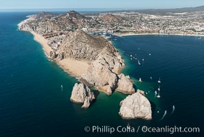
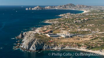
Aerial photograph of Land's End and the Arch, Cabo San Lucas, Mexico
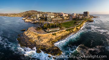
Aerial Photo of Point La Jolla and Scripps Park, La Jolla Coastline
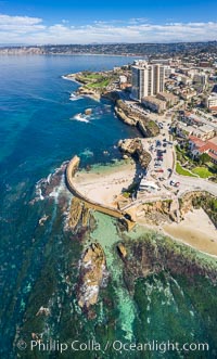
Childrens Pool Reef Exposed at Extreme Low Tide, Aerial View, La Jolla, California. Aerial panoramic photograph.
Los Islotes, famous for its friendly colony of California sea lions, part of Archipelago Espiritu Santo, Sea of Cortez, Aerial Photo
North Coronado Island, Mexico, northern point looking south with Middle and South Islands in the distance, aerial photograph.
Clipperton Rock, a 95' high volcanic remnant, is the highest point on Clipperton Island, a spectacular coral atoll in the eastern Pacific. By permit HC / 1485 / CAB (France)
Dawn breaks over the Bentonite Hills in the Utah Badlands. Striations in soil reveal layers of the Morrison Formation, formed in swamps and lakes in the Jurassic era. Aerial panoramic photograph.
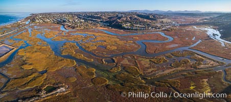
San Elijo Lagoon aerial photo, panorama
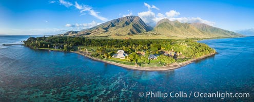
Olowalu reef and West Maui mountains, Maui, Hawaii, aerial photo
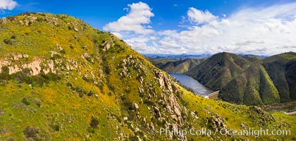
Spring Flowers and Grasses, aerial panoramic photo, Del Dios and Lake Hodges, San Diego
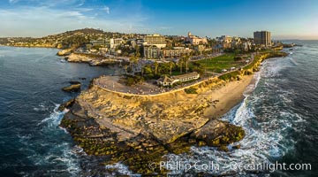
Point La Jolla and Scripps Park aerial photo, sunset, sea lions and sea gulls and tourists looking down on Boomer Beach. Aerial panoramic photo.
Aerial Photo of Point La Jolla and Scripps Park, La Jolla Coastline
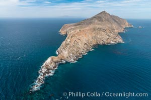
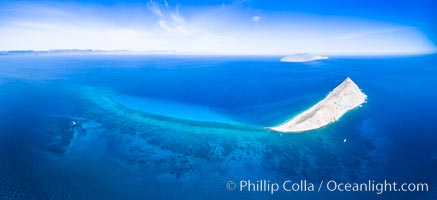
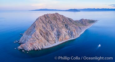
Boat Horizon at San Clemente Island
Childrens Pool seawall and Casa Cove aerial photo, La Jolla, California. Sunset. Aerial panoramic photograph.
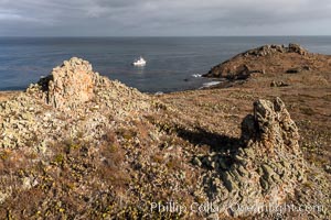
Boat Horizon at San Clemente Island
La Jolla Caves and Coastline, Goldfish Point, Aerial Panoramic Photo
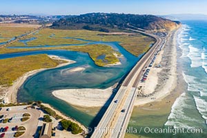
Los Penasquitos Lagoon and Torrey Pines State Beach, aerial photo
Seymour Narrows with strong tidal currents. Between Vancouver Island and Quadra Island, Seymour Narrows is about 750 meters wide and has currents reaching 15 knots. Aerial photo.
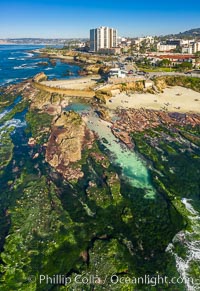
Childrens Pool Reef Exposed at Extreme Low King Tide, La Jolla, California. Aerial panoramic photograph.
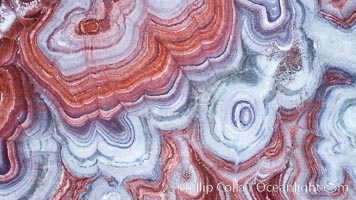
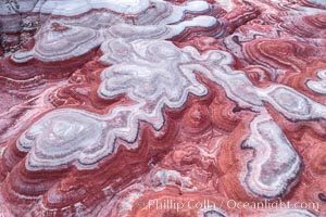
Fantastic colorful sedimentary patterns, Bentonite layers are seen as striations exposed in the Utah Badlands, part of the Chinle Formation formed during the Upper Triassic Period. Aerial photograph.
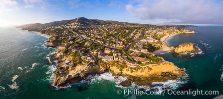
Laguna Beach Coastline including Views South to Three Arch Bay, Aerial Photo
Aerial photo of gray whale calf and mother. This baby gray whale was born during the southern migration, far to the north of the Mexican lagoons of Baja California where most gray whale births take place.
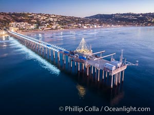
Scripps Pier and Christmas Lights, La Jolla Coastline, Aerial view
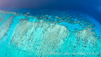
Aerial View of Vatu-i-Ra Coral Seascape, Fiji
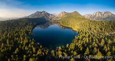
Cascade Lake near Lake Tahoe, aerial photo
Middle Coronado Rock Island, aerial photo
Swamis Reef viewed from above, Encinitas, California
Solana Beach and Del Mar dog beach, aerial panoramic photo
Fletcher Cove and Solana Beach Aerial Photo, aerial panorama of Pillbox and Solana Beach coastline
Blacks Beach and Mushroom House, aerial photo
Fletcher Cove and Pillbox Beach at sunset, panoramic aerial photograph
Balaklava Island at sunset, aerial photo, Vancouver Island, Canada
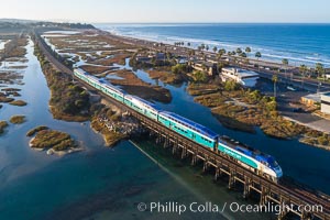
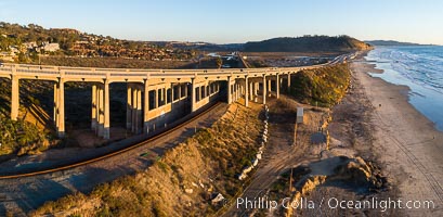
Amtrak train over San Elijo Lagoon, Encinitas
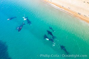
Ten southern right whales very close to shore, including four calves and a rare white calf, people watching from the beach, Playa El Doradillo, aerial photo, Patagonia, Argentina
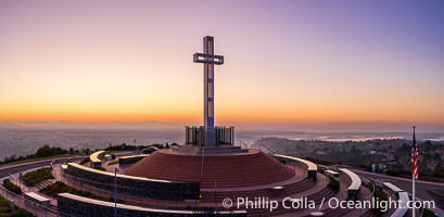
Sunrise over The Mount Soledad Cross, a landmark in La Jolla, California. The Mount Soledad Cross is a 29-foot-tall cross erected in 1954. Aerial photo.
Abalone Point and Cameo Cove, Laguna Beach, Aerial Photo
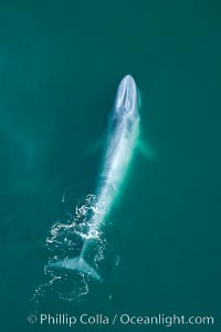
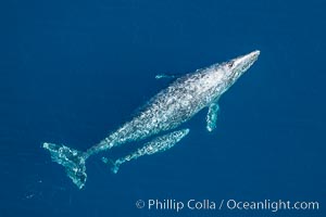
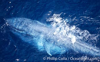
Blue whale swims at the surface of the ocean in this aerial photograph. Balaenoptera musculus.
Sandstone Fins at sunset, near Moab Utah. Fins like these form in sandstone and eventually some will continue to erode until natural stone arches, such as those in Arches National Park.
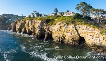
La Jolla Caves and the Coast Walk, La Jolla. Aerial panoramic photograph.
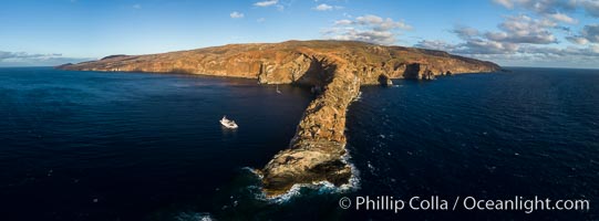
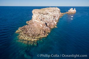
Point Bennett, San Miguel Island, aerial photograph
Mother and calf southern right whale stir up sand in shallow water, aerial photo. The water is so shallow that just by swimming the mother and calf can stir up the sand beneath them.
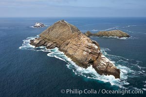
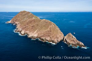
Webster Point, Santa Barbara Island, aerial photograph
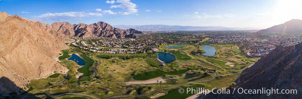
La Quinta and Coachella Valley, aerial view, panorama
Gray whale blowing at the ocean surface, exhaling and breathing as it prepares to dive underwater.
Atop South Coronado Island, aerial photo
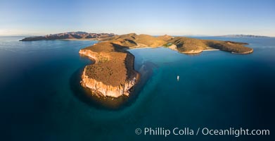
Punta Colorada and San Gabriel Bay, aerial photo, Isla Espiritu Santo, Sea of Cortez, Mexico
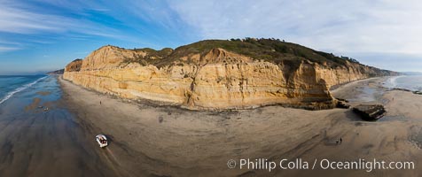
180-degree north-south panorama of Torrey Pines State Reserve seacliffs, with flat rock and Torrey Pines State Beach, photographed with a balloon aerial survey photography rig.
Middle Coronado Island, aerial photo
Stone Steps Beach at Sunset, Aerial Panorama, Encinitas, California
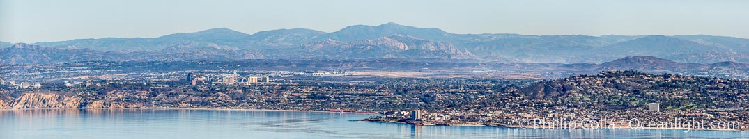
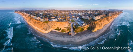
Aerial Panorama of La Jolla, University City, showing (from left) UCSD, University City, Scripps Institution of Oceanography, La Jolla Shores, Point La Jolla, Mount Soledad, in the background some of the mountains to the east of San Diego. The highest peak in the center of the panoram is Cuyamaca Peak (6512') while the rocky peak directly in front of it is El Cajon Mountain (3675').
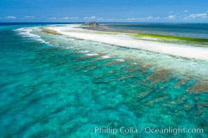
Coral Reef at Clipperton Island, aerial photo. Clipperton has healthy, beautiful coral reefs. The white beaches are composed of white coralline rubble. Clipperton Island, a minor territory of France also known as Ile de la Passion, is a spectacular coral atoll in the eastern Pacific. By permit HC / 1485 / CAB (France)
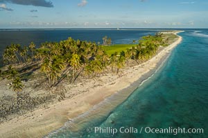
Coconut palm trees on Clipperton Island, aerial photo. Clipperton Island is a spectacular coral atoll in the eastern Pacific. By permit HC / 1485 / CAB (France)
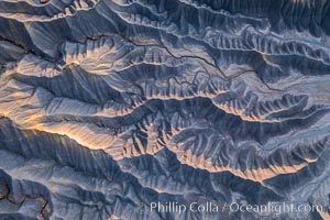
Erosion patterns in the Utah Badlands, aerial abstract photo.
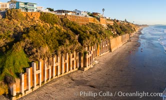
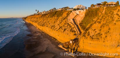
Falling bluffs and reinforcements, buttressing, Encinitas and Leucadia. These bluffs are coming down, its only a matter of time, but residents spend to prop up the bluffs and keep their homes from falling into the ocean.
San Miguel Island, aerial photograph
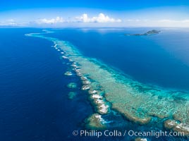
Aerial View of Namena Marine Reserve and Coral Reefs, Namena Island, Fiji
Inquisitive southern right whale visits a boat, Eubalaena australis, aerial photo
Del Mar Coastline and Bridge at sunset, aerial photo, Torrey Pines and La Jolla in the distance
San Miguel Island south side, aerial photograph
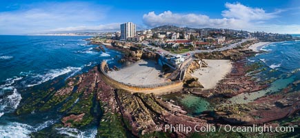
Childrens Pool Reef Exposed at Extreme Low King Tide, La Jolla, California. Aerial panoramic photograph.
Anacapa Island, west end, aerial photo
Wilson Arch aerial photo, Moab, Utah. Wilson Arch has a span of 91 feet (28 m) and height of 46 feet (14 m)
Anacapa Island, aerial photo
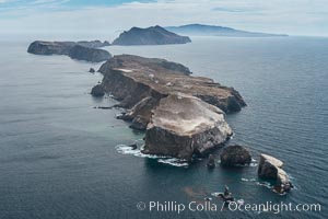
Anacapa Island, east end, aerial photo
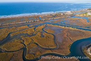
San Elijo Lagoon Aerial Photo, Encinitas, California
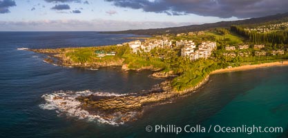
Kapalua Maui with Hawea Point and Namalu Bay, Sunset, West Maui, aerial photo
Coral Reef at Clipperton Island, aerial photo. Clipperton has healthy, beatiful coral reefs. The white beaches are composed of white coralline rubble. Clipperton Island, a minor territory of France also known as Ile de la Passion, is a spectacular coral atoll in the eastern Pacific. By permit HC / 1485 / CAB (France)
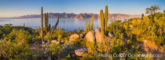
Isla San Francisquito, Aerial View, Sea of Cortez
Aerial Photo of North Coronado Island, Baja California, Mexico, viewed from the southwest. The Keyhole, a spectacular narrow cut and underwater tunnel through the island, is seen at the narrow neck of the island. The San Diego and Tijuana coastline is visible in the distance.
Isla San Diego and Coral Reef, reef extends from Isla San Diego to Isla San Jose, aerial photo, Sea of Cortez, Baja California
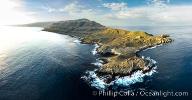
San Clemente Island aerial photo, Pyramid Head and Balanced Rock at the southern end of the island. San Clemente Island Pyramid Head, the distinctive pyramid shaped southern end of the island, exhibits distinctive geologic terracing, underwater reefs and giant kelp forests
Cardon Cactus on Isla San Diego, Aerial View, Baja California
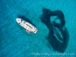
Boat Ambar at Isla San Diego, Aerial View, Sea of Cortez
Stone Steps Beach at Sunset, Aerial Panorama, Encinitas, California
Lower Blue Hills Badlands, sunrise, Utah
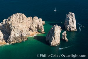
Aerial photograph of Land's End and the Arch, Cabo San Lucas, Mexico
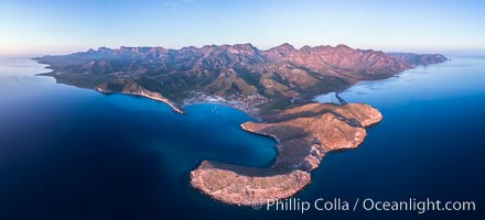
San Evaristo at dawn, panoramic view, a small fishing town, aerial photo, Sea of Cortez, Baja California
Boat Ambar and School of Fish, Ensenada el Embudo, Isla Partida, aerial photo
Punta Alta and La Cueva, Baja California, Sea of Cortez, aerial photograph
Cardon Cactus on Isla San Jose, Aerial View, Baja California
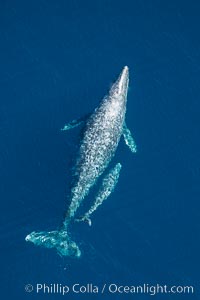
Aerial photo of gray whale calf and mother. This baby gray whale was born during the southern migration, far to the north of the Mexican lagoons of Baja California where most gray whale births take place.
Isla Las Animas, panoramic aerial photo, Sea of Cortez
Punta Ballena, Faro Cabesa Ballena (foreground), Medano Beach and Land's End (distance). Residential and resort development along the coast near Cabo San Lucas, Mexico.
Isla San Jose, Aerial Photo, Sea of Cortez
Natural Salt Lake on Isla San Jose, Aerial View, Sea of Cortez
Sunrise over Isla San Francisquito, Aerial View, Sea of Cortez
Honolua Bay in West Maui aerial photo, morning, with snorkel boat at anchor, panorama
The Children's Pool in La Jolla, also known as Casa Cove, is a small pocket cove protected by a curving seawall, with the rocky coastline and cottages and homes of La Jolla seen behind it.
Boat Ambar at Isla San Diego, Aerial View, Sea of Cortez
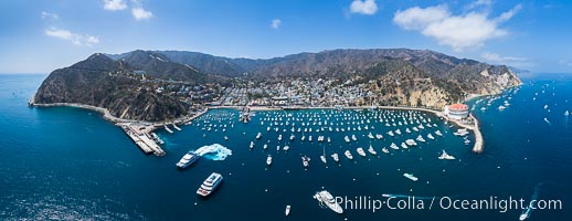
Aerial Photo of Avalon and Catalina Island.
Isla Cayo, Aerial Photo, Sea of Cortez, Baja California
Predawn Sunrise Light over Isla San Francisquito, Aerial View, Sea of Cortez
Seymour Narrows with strong tidal currents. Between Vancouver Island and Quadra Island, Seymour Narrows is about 750 meters wide and has currents reaching 15 knots. Aerial photo.

Aerial View of Namena Marine Reserve and Coral Reefs, Namena Island, Fiji
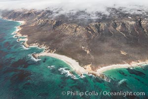
Coastal mountains and clouds, Tofino, Vancouver Island, Canada
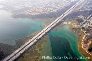
Batiquitos Lagoon aerial view, showing coastline and Interstate 5 freeway.
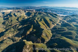
San Diego mountains, aerial photograph.
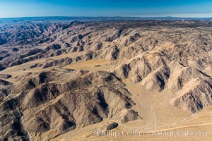
Jacumba Mountains and In-Ko-Pah Mountains, east of San Diego, showing erosion as the mountain range ends and meets desert habitat.
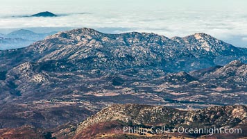
San Diego mountains, with the Sawtooth Mountain Range in the distance, near Mount Laguna.
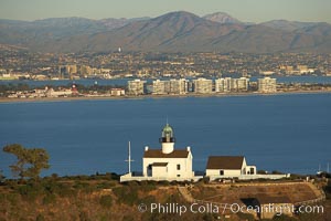
Old Point Loma Lighthouse, sitting high atop the end of Point Loma peninsula, seen here with San Diego Bay and downtown San Diego in the distance. The old Point Loma lighthouse operated from 1855 to 1891 above the entrance to San Diego Bay. It is now a maintained by the National Park Service and is part of Cabrillo National Monument
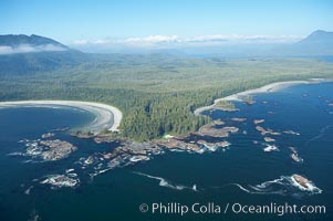
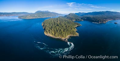
Cow Bay (left) and Flores Island, aerial photo, part of Clayoquot Sound, near Tofino on the west coast of Vancouver Island.
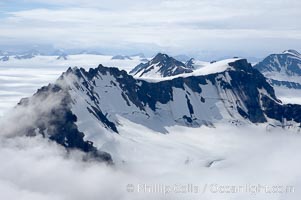
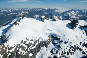
Kenai Fjords National Park, Alaska
Kenai Range, Alaska
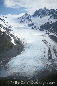
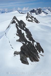
Glacier, Resurrection Mountains, Alaska
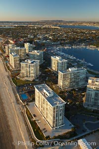
Coronado Shores, a group of 10 condominium buildings south of the Hotel Del, on the water on Coronado Island.