Childrens Pool Reef Exposed at Extreme Low Tide, La Jolla, California. Aerial panoramic photograph.
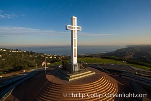
Sunrise over The Mount Soledad Cross, a landmark in La Jolla, California. The Mount Soledad Cross is a 29-foot-tall cross erected in 1954. Aerial photo
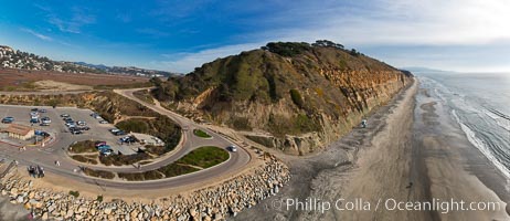
Seacliffs, Torrey Pines State Reserve, La Jolla, aerial photo.
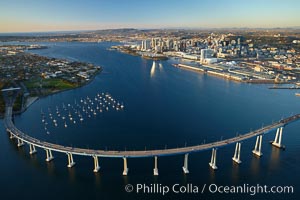
Aerial photo of the San Diego Coronado Bridge, which links San Diego with Coronado Island.
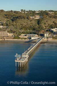
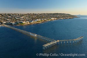
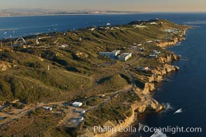
Scripps Institute of Oceanography research pier, La Jolla.
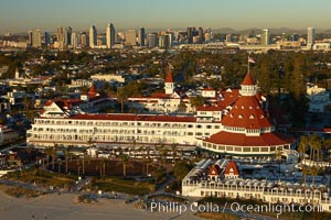
Hotel del Coronado, Coronado Island, aerial photo.
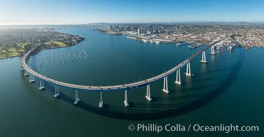
Panoramic Aerial Photo of San Diego Coronado Bay Bridge
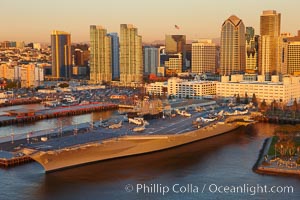
Aerial photo of downtown San Diego and USS Midway aircraft carrier museum.
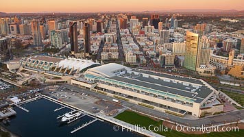
Aerial photo of the San Diego Convention Center, located in the Marina District of downtown San Diego.
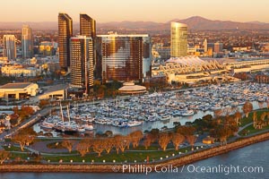
Aerial photo of the Marriott Hotel towers, rising above the Embarcadero Marine Park and yacht marina.
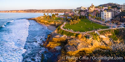
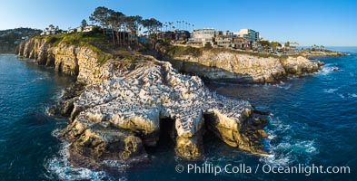
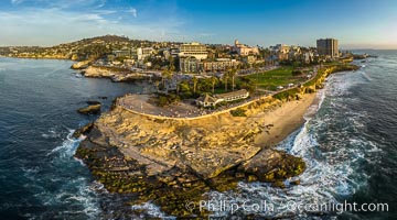
Aerial Photo of Point La Jolla and Scripps Park, La Jolla Coastline
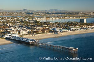
Aerial photo of Crystal Pier, Pacific Beach.
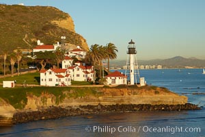
New Point Loma Lighthouse, situated on the tip of Point Loma Peninsula, marks the entrance to San Diego Bay. The lighthouse rises 70' and was built in 1891 to replace the ""old"" Point Loma Lighthouse which was often shrouded in fog.
Del Mar Coastline at Sunset, Aerial Photo
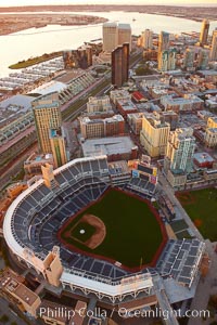
Downtown San Diego and Petco Park, viewed from the southeast.
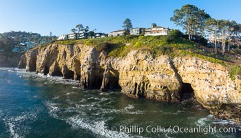
Goldfish Point and La Jolla Caves aerial photograph, La Jolla.
Childrens Pool and La Jolla coastline at sunset, aerial panorama, showing underwater reef exposed at King Low Tide
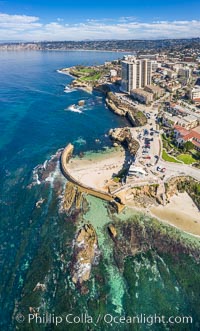
Childrens Pool Reef Exposed at Extreme Low Tide, Aerial View, La Jolla, California. Aerial panoramic photograph.
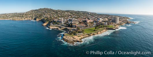
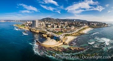
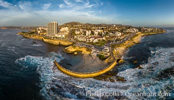
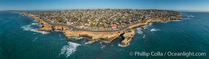
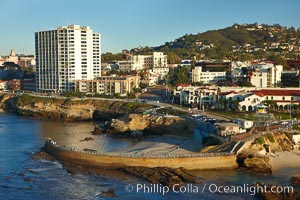
Aerial Panoramic Photo of Point La Jolla and La Jolla Cove, Boomer Beach, Scripps Park. Panoramic aerial photograph of La Jolla Cove and Scripps Parks (center), with La Jolla’s Mount Soledad rising above, La Jolla Shores and La Jolla Caves to the left and the La Jolla Coast with Children’s Pool (Casa Cove) to the right. The undersea reefs of Boomer Beach are seen through the clear, calm ocean waters. This extremely high resolution panorama will print 50″ high by 130″ long with no interpolation
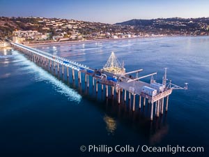
Scripps Pier and Christmas Lights, La Jolla Coastline, Aerial view
La Jolla Caves and the Coast Walk, La Jolla. Aerial panoramic photograph.
Blacks Beach and Mushroom House, aerial photo
Fletcher Cove and Solana Beach Aerial Photo, aerial panorama of Pillbox and Solana Beach coastline
Solana Beach and Del Mar dog beach, aerial panoramic photo
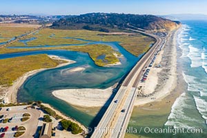
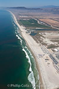
Los Penasquitos Lagoon and Torrey Pines State Beach, aerial photo
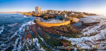
Childrens Pool seawall and Casa Cove aerial photo, La Jolla, California. Sunset. Aerial panoramic photograph.
Point La Jolla and Scripps Park aerial photo, sunset, sea lions and sea gulls and tourists looking down on Boomer Beach. Aerial panoramic photo.
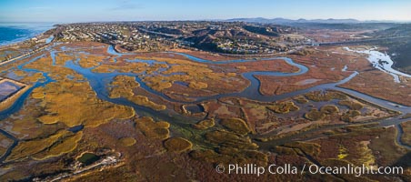
San Elijo Lagoon aerial photo, panorama
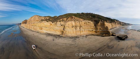
180-degree north-south panorama of Torrey Pines State Reserve seacliffs, with flat rock and Torrey Pines State Beach, photographed with a balloon aerial survey photography rig.
Camp Pendleton, Pacific coastline, north of San Diego county and the city of Oceanside. Marine Corps Base Camp Pendleton.
Aerial Panoramic Photo of Sunset Cliffs San Diego, Pappy's Point, Claiborne Cove
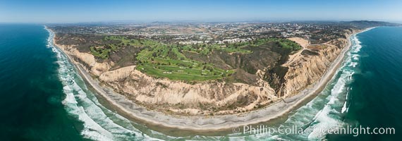
Aerial panorama of Blacks Beach, Torrey Pines Golf Course (south course), and views to La Jolla (south) and Carlsbad (north)
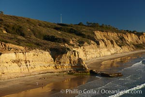
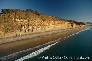
Torrey Pines seacliffs, rising up to 300 feet above the ocean, stretch from Del Mar to La Jolla. On the mesa atop the bluffs are found Torrey pine trees, one of the rare species of pines in the world.
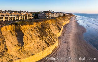
Solana Beach sea cliffs and coastline, aerial view.
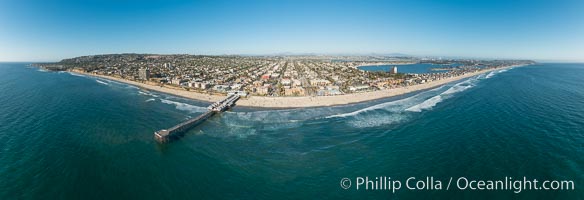
Aerial Panoramic Photo of Crystal Pier and Pacific Beach Coastline
Ocean Beach Pier, also known as the OB Pier or Ocean Beach Municipal Pier, is the longest concrete pier on the West Coast measuring 1971 feet (601 m) long. Sunset Cliffs and Point Loma extend off to the south.
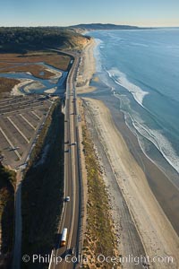
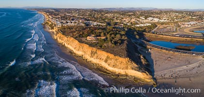
Coast Highway 101, looking south from Del Mar, with Los Penasquitos Marsh on the left and the cliffs of Torrey Pines State Reserve and La Jolla in the distance.
Point Loma peninsula, with scalloped sandstone cliffs edging the Pacific Ocean, looking south. Navy facilities are scattered along this section of Point Loma.
The Children's Pool in La Jolla, also known as Casa Cove, is a small pocket cove protected by a curving seawall, with the rocky coastline and cottages and homes of La Jolla seen behind it.
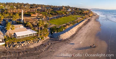
Powerhouse Park and Beach in Del Mar at sunset, aerial photo
Torrey Pines balloon aerial survey photo. Torrey Pines seacliffs, rising up to 300 feet above the ocean, stretch from Del Mar to La Jolla. On the mesa atop the bluffs are found Torrey pine trees, one of the rare species of pines in the world. Peregine falcons nest at the edge of the cliffs. This photo was made as part of an experimental balloon aerial photographic survey flight over Torrey Pines State Reserve, by permission of Torrey Pines State Reserve.
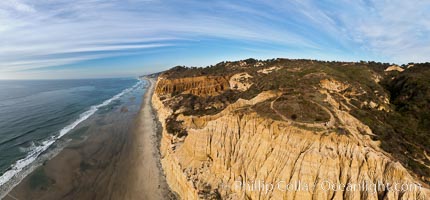
Torrey Pines balloon aerial survey photo. Torrey Pines seacliffs, rising up to 300 feet above the ocean, stretch from Del Mar to La Jolla. On the mesa atop the bluffs are found Torrey pine trees, one of the rare species of pines in the world. Peregine falcons nest at the edge of the cliffs. This photo was made as part of an experimental balloon aerial photographic survey flight over Torrey Pines State Reserve, by permission of Torrey Pines State Reserve.
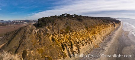
Torrey Pines balloon aerial survey photo. Torrey Pines seacliffs, rising up to 300 feet above the ocean, stretch from Del Mar to La Jolla. On the mesa atop the bluffs are found Torrey pine trees, one of the rare species of pines in the world. Peregine falcons nest at the edge of the cliffs. This photo was made as part of an experimental balloon aerial photographic survey flight over Torrey Pines State Reserve, by permission of Torrey Pines State Reserve.
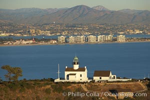
Old Point Loma Lighthouse, sitting high atop the end of Point Loma peninsula, seen here with San Diego Bay and downtown San Diego in the distance. The old Point Loma lighthouse operated from 1855 to 1891 above the entrance to San Diego Bay. It is now a maintained by the National Park Service and is part of Cabrillo National Monument
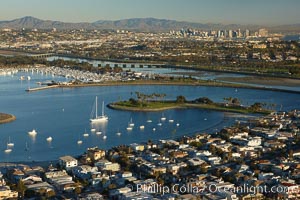
Mission Bay in San Diego, California.
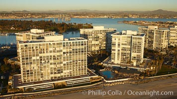
Coronado Shores, a group of 10 condominium buildings south of the Hotel Del, on the water on Coronado Island.
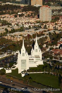
San Diego Mormon Temple, is seen amid the office and apartment buildings and shopping malls of University City.