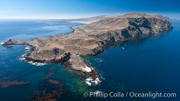
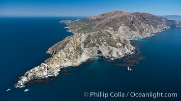
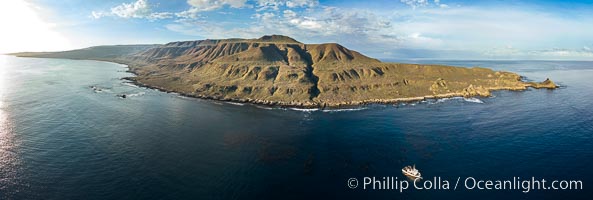
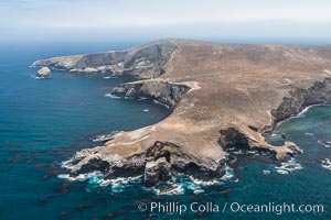
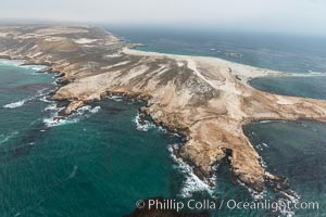
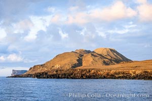
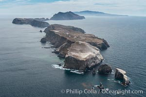
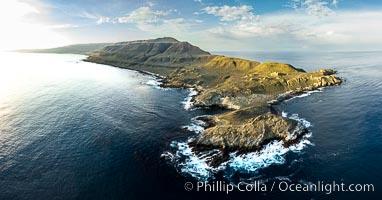
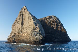
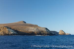
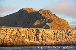
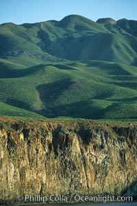
San Clemente Island Pyramid Head, showing geologic terracing, underwater reefs and giant kelp forests
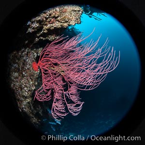
Red gorgonian on rocky reef, below kelp forest, underwater. The red gorgonian is a filter-feeding temperate colonial species that lives on the rocky bottom at depths between 50 to 200 feet deep. Gorgonians are typically oriented at right angles to prevailing water currents to capture plankton drifting by.
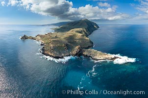
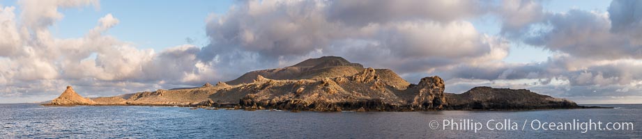
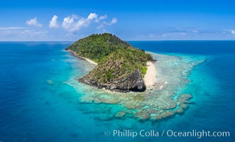
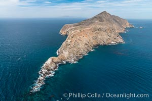
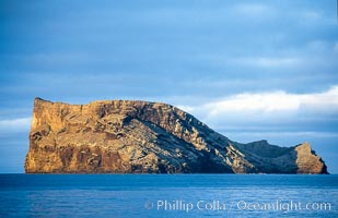
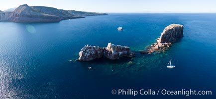
Cabo Pearce on Socorro Island, aerial photo, Revillagigedos Islands, Mexico
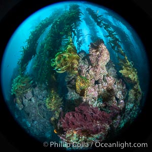
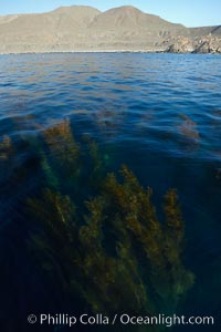
The Kelp Forest and Rocky Reef of San Clemente Island. Giant kelp grows rapidly, up to 2' per day, from the rocky reef on the ocean bottom to which it is anchored, toward the ocean surface where it spreads to form a thick canopy. Myriad species of fishes, mammals and invertebrates form a rich community in the kelp forest. Lush forests of kelp are found throughout California's Southern Channel Islands
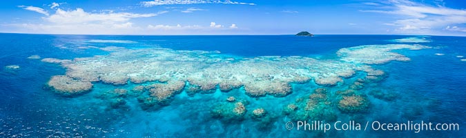
Aerial View of Namena Marine Reserve and Coral Reefs, Namena Island, Fiji
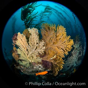
Parasitic zoanthid anemones cover, encrust and overwhelm a golden gorgonian. The gorgonian on the left has been completely parasitized by zoanthid anemones, while the gorgonian to the right remains free of zoanthids (for now). A garibaldi swims below the two sea fans. The golden gorgonian is a filter-feeding temperate colonial species that lives on the rocky bottom at depths between 50 to 200 feet deep. Each individual polyp is a distinct animal, together they secrete calcium that forms the structure of the colony. Gorgonians are oriented at right angles to prevailing water currents to capture plankton drifting by.
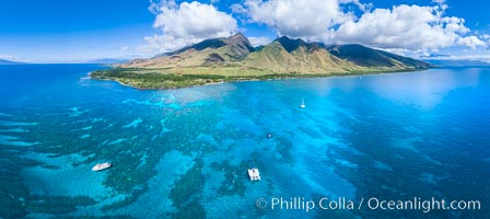
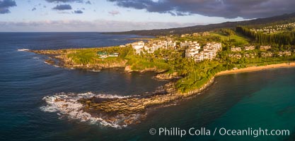
Olowalu reef and West Maui mountains, Maui, Hawaii, aerial photo
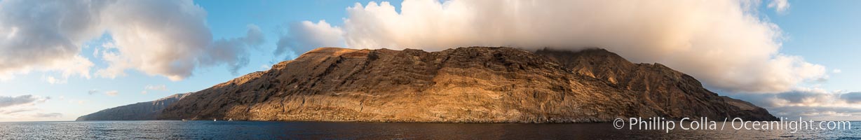
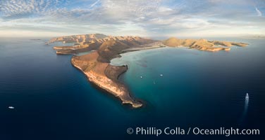
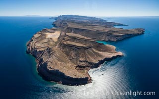
San Clemente Island aerial photo, Pyramid Head and Balanced Rock (China Hat) at the southern end of the island. San Clemente Island Pyramid Head, the distinctive pyramid shaped southern end of the island, exhibits distinctive geologic terracing, underwater reefs and giant kelp forests
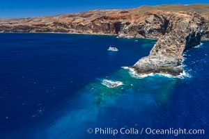
Aerial photo of the West End of Catalina Island
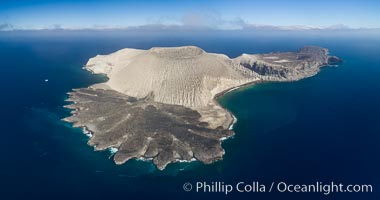
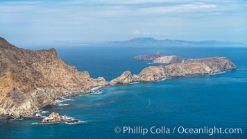
San Benedicto Island and Barcena crater, aerial photo, Revillagigedos Islands, Mexico
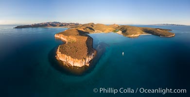
Isla San Francisquito, Aerial Photo, Sea of of Cortez
Panorama of Punta Norte, the north end of Guadalupe Island
Guadalupe Island at sunrise, panorama. Volcanic coastline south of Pilot Rock and Spanish Cove, near El Faro lighthouse. Guadalupe Island (Isla Guadalupe), Baja California, Mexico.
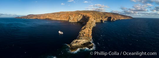
Panoramic Photo of San Clemente Island, Sunrise, Pyramid Head
Makena Beach State Park aerial photo, Maui, Hawaii. Big Beach on the right, Little Beach on the left, Haleakala rising in the distance on the right, West Maui Mountains in the distance on the left.
San Clemente Island aerial photo, Pyramid Head and Balanced Rock at the southern end of the island. San Clemente Island Pyramid Head, the distinctive pyramid shaped southern end of the island, exhibits distinctive geologic terracing, underwater reefs and giant kelp forests
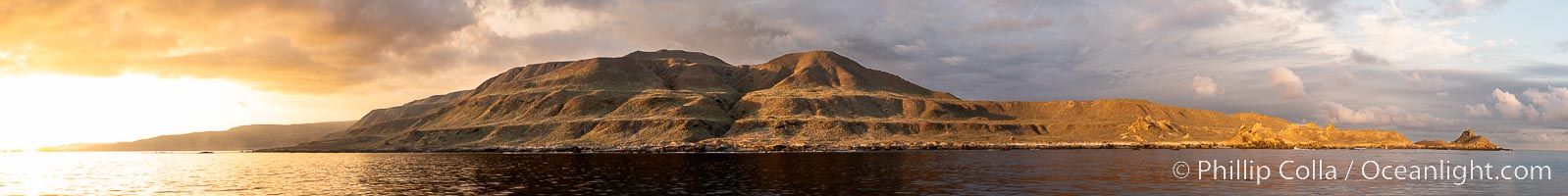
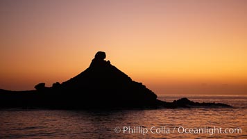
Sunset at San Clemente Island, south end showing Pyramid Head. Panoramic photo.
Aerial View of Namena Island, Fiji
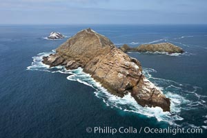
Middle Coronado Island, Islas Coronado, Mexico, viewed from the south.
North Coronado Island, Mexico, northern point looking south with Middle and South Islands in the distance, aerial photograph.
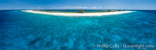
Aerial panorama of Clipperton Island, showing the entire atoll. Clipperton Island, a minor territory of France also known as Ile de la Passion, is a small (2.3 sq mi) but spectacular coral atoll in the eastern Pacific. By permit HC / 1485 / CAB (France)
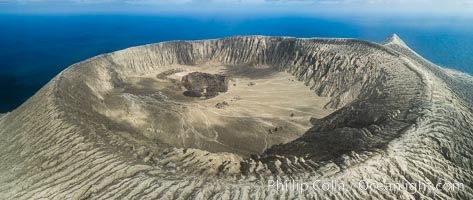
Barcena volcano crater, highest point on San Benedicto Island, Revillagigedos, Mexico
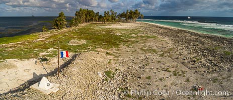
The French tricolor flag flies over Clipperton Island at sunset. Clipperton Island, a minor territory of France also known as Ile de la Passion, is a spectacular coral atoll in the eastern Pacific. By permit HC / 1485 / CAB (France)
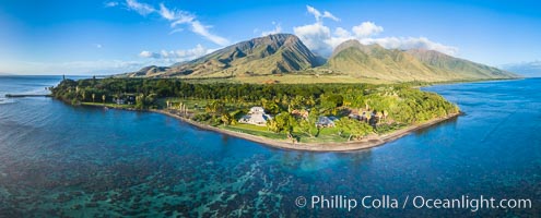
Olowalu reef and West Maui mountains, Maui, Hawaii, aerial photo
Aerial View of Vatu-i-Ra Coral Seascape, Fiji
Webster Point, Santa Barbara Island, aerial photograph
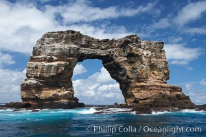
Darwin's Arch, Darwin Island, Galapagos. Darwin's Arch broke and fell into the ocean in June 2021.
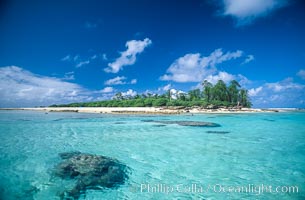
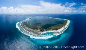
Rose Island, Rose Atoll NWR, American Samoa
Point Bennett, San Miguel Island, aerial photograph
Punta Colorada and San Gabriel Bay, aerial photo, Isla Espiritu Santo, Sea of Cortez, Mexico
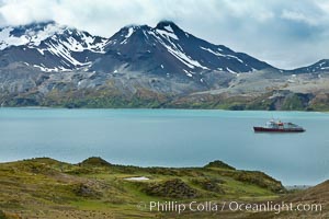
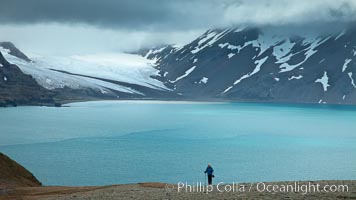
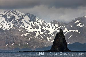
Mountains, glaciers and ocean, near Grytviken, South Georgia Island, Southern Ocean.
Catalina Island, West End.
Sunrise on morros near south end of Guadalupe Island.
Cabo Pearce on Socorro Island, aerial photo, Revillagigedos Islands, Mexico
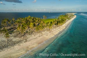
Coconut palm trees on Clipperton Island, aerial photo. Clipperton Island is a spectacular coral atoll in the eastern Pacific. By permit HC / 1485 / CAB (France)
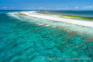
Coral Reef at Clipperton Island, aerial photo. Clipperton has healthy, beautiful coral reefs. The white beaches are composed of white coralline rubble. Clipperton Island, a minor territory of France also known as Ile de la Passion, is a spectacular coral atoll in the eastern Pacific. By permit HC / 1485 / CAB (France)
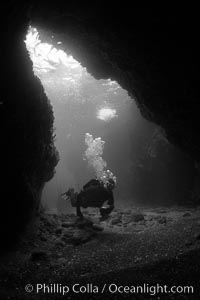
A SCUBA diver enters a submarine cavern at Santa Barbara Island, underwater cave.
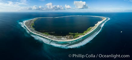
Aerial panorama of Clipperton Island, showing the entire atoll. Clipperton Island, a minor territory of France also known as Ile de la Passion, is a small (2.3 sq mi) but spectacular coral atoll in the eastern Pacific. By permit HC / 1485 / CAB (France)
Anacapa Island, aerial photo
Anacapa Island, west end, aerial photo
Anacapa Island, east end, aerial photo
San Miguel Island south side, aerial photograph
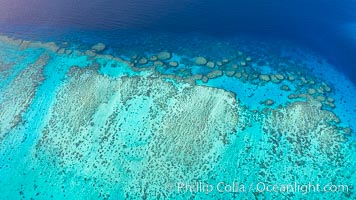
coralline algae reef.
San Miguel Island, aerial photograph
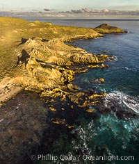
San Clemente Island aerial photo, Pyramid Head and Balanced Rock at the southern end of the island. San Clemente Island Pyramid Head, the distinctive pyramid shaped southern end of the island, exhibits distinctive geologic terracing, underwater reefs and giant kelp forests
Isla Afuera, Guadalupe Island, daybreak.
Boat Horizon below eastern cliffs of Isla Afuera, sunrise.
Clouds held back by island crest, near the north end of Guadalupe Island off the coast of Baja California, Mexico.
San Clemente Island aerial photo, Pyramid Head and Balanced Rock at the southern end of the island. San Clemente Island Pyramid Head, the distinctive pyramid shaped southern end of the island, exhibits distinctive geologic terracing, underwater reefs and giant kelp forests
Kapalua Maui with Hawea Point and Namalu Bay, Sunset, West Maui, aerial photo
East face and shoreline of southernmost morro, daybreak.
Coral Reef at Clipperton Island, aerial photo. Clipperton has healthy, beatiful coral reefs. The white beaches are composed of white coralline rubble. Clipperton Island, a minor territory of France also known as Ile de la Passion, is a spectacular coral atoll in the eastern Pacific. By permit HC / 1485 / CAB (France)
Punta Prieta and San Gabriel Bay, Aerial Photo, Sunset
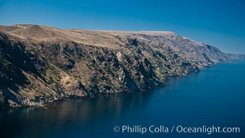
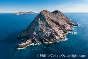
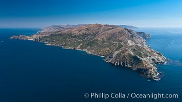
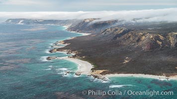
San Clemente Island, aerial photo, steep cliffs and mountainous terrain on the south eastern shore of the island.
Isla Partida north end and Punta Maru, aerial photo, Sea of Cortez
La Reina Lighthouse Reef, Sea of Cortez, aerial photo
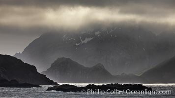
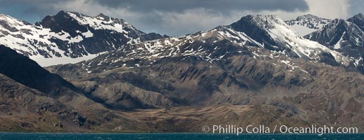
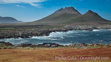
South Georgia Island coastline, showing the island's characteristic rugged topography. 56% of the island is covered by 161 glaciers, which have created numerous large bays and inlets that provide excellent habitat for marine animals and seabirds. Mountains meet the sea in steep-sided seacliffs covered with sparse vegetation. The highest point on South Georgia Island is Mt. Paget at 2,915m.
Fortuna Bay, South Georgia Island
Aerial View of Namena Marine Reserve and Coral Reefs, Namena Island, Fiji
Honolua Bay in West Maui aerial photo, morning, with snorkel boat at anchor, panorama
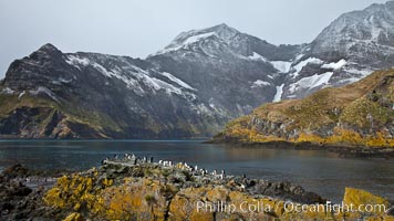
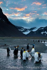
King penguin colony and the Bay of Isles on the northern coast of South Georgia Island, Aptenodytes patagonicus.
San Clemente Island aerial photo, Pyramid Head and Balanced Rock at the southern end of the island. San Clemente Island Pyramid Head, the distinctive pyramid shaped southern end of the island, exhibits distinctive geologic terracing, underwater reefs and giant kelp forests
South Coronado Island, Mexico, northern point showing underwater reef structure, aerial photograph.
South Coronado Island, Mexico, eastern side, Middle and North Islands in the distance, aerial photograph.
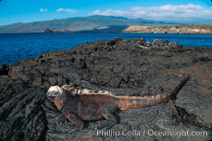
Marine Iguana, James Island, Galapagos
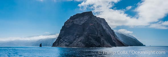
Steeple Jason Island, Falklands
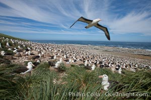
Black-browed albatross in flight, over the enormous colony at Steeple Jason Island in the Falklands.
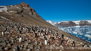
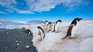
Adelie penguins at the nest, a colony on the slopes of Devil Island, Antarctica. Pygoscelis adeliae.
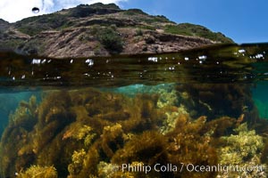
Feather boa kelp and other marine algae cover the rocky reef.
Los Islotes, part of Archipelago Espiritu Santo, Sea of Cortez, Aerial Photo
Macaroni penguins, on the rocky shoreline of Hercules Bay, South Georgia Island. One of the crested penguin species, the macaroni penguin bears a distinctive yellow crest on its head. They grow to be about 12 lb and 28"" high. Macaroni penguins eat primarily krill and other crustaceans, small fishes and cephalopods.
Northeastern coast of Steeple Jason Island, looking toward the southern half of the island. Steeple Jason is one of the remote Jason Group of Islands in the West Falklands. Uninhabited, the island is spectacular both for its rugged scenery and its enormous breeding colony of black-browed albatross. Steeple Jason Island is now owned and administered by the Wildlife Conservation Society.
Gentoo penguins coming ashore, New Island, Falkland Islands. Pygoscelis papua.
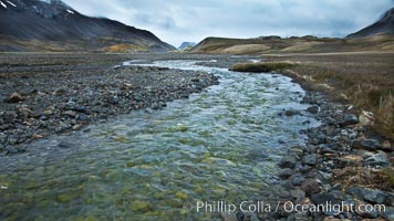
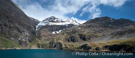
Glacial melt waters, runoff, flows across an alluvial flood plain between mountains, on its way to Stromness Bay.
A hiker ascends the slopes of South Georgia Island above Fortuna Bay.
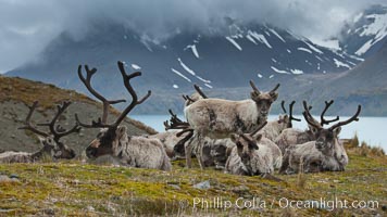
Reindeer on South Georgia Island. Reindeer (known as caribou when wild) were introduced to South Georgia Island by Norway in the early 20th Century. There are now two distinct herds which are permanently separated by glaciers.
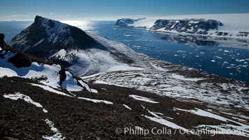
Summit of Devil Island, with Vega Island in the distance.
Hercules Bay, South Georgia Island
Adelie penguins, Paulet Island, Antarctic Peninsula. Pygoscelis adeliae.
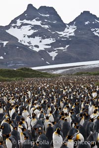
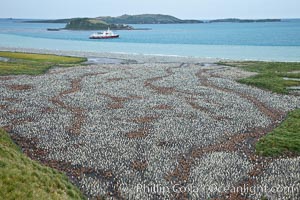
King penguin colony at Salisbury Plain, Bay of Isles, South Georgia Island. Over 100,000 pairs of king penguins nest here, laying eggs in December and February, then alternating roles between foraging for food and caring for the egg or chick.
King penguin colony, Right Whale Bay, South Georgia Island. Over 100,000 pairs of king penguins nest on South Georgia Island each summer.
South Georgia Island coastline, showing the island's characteristic rugged topography. 56% of the island is covered by 161 glaciers, which have created numerous large bays and inlets that provide excellent habitat for marine animals and seabirds. Mountains meet the sea in steep-sided seacliffs covered with sparse vegetation. The highest point on South Georgia Island is Mt. Paget at 2,915m.
Steeple Jason Island at sunrise, one of the remote Jason Group of Islands in the West Falklands. Uninhabited, the island is spectacular both for its rugged scenery and its enormous breeding colony of black-browed albatross. Steeple Jason Island is now owned and administered by the Wildlife Conservation Society.
Interesting rock formations on plateau atop New Island, with sheer rugged seacliffs and the ocean beyond.
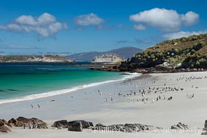
Beautiful white sand beach, on the southern tip of Carcass Island, with gentoo and Magellanic penguins coming and going to sea.
Devil Island, Antarctica Peninsula.
Adelie penguins, nesting, part of the enormous colony on Paulet Island, with the tall ramparts of the island and clouds seen in the background. Adelie penguins nest on open ground and assemble nests made of hundreds of small stones.
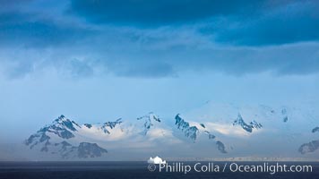
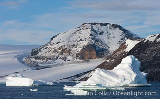
Distant icebergs, mountains, clouds, ocean at dawn, in the South Shetland Islands, near Deception Island.
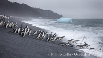
Chinstrap penguins at Bailey Head, Deception Island. Chinstrap penguins enter and exit the surf on the black sand beach at Bailey Head on Deception Island. Bailey Head is home to one of the largest colonies of chinstrap penguins in the world.
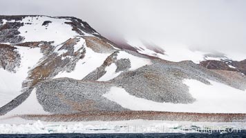
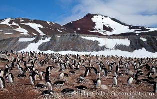
Enormous colony of Adelie penguins covers the hillsides of Paulet Island.
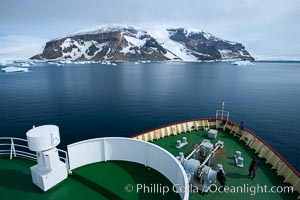
M/V Polar Star on its way to Brown Bluff in the Antarctic Sound.
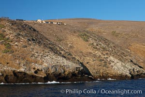
Western landing and National Park buildings on Santa Barbara Island, part of the Channel Islands National Marine Sanctuary. Santa Barbara Island lies 38 miles offshore of the coast of California, near Los Angeles and San Pedro.
Sutil Island,a small barren island near Santa Barbara Island, part of the Channel Islands National Marine Sanctuary. Santa Barbara Island lies 38 miles offshore of the coast of California, near Los Angeles and San Pedro.
Northwest promontory of Santa Barbara Island, part of the Channel Islands National Marine Sanctuary. Santa Barbara Island lies 38 miles offshore of the coast of California, near Los Angeles and San Pedro.
A forest of giant kelp, growing just below the ocean surface along the shores of San Clemente Island.
China Hat Point, San Clemente Island, sunrise.
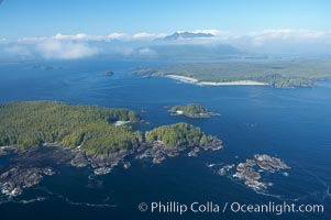
Blunden Island (foreground) and Vargas Island (distance), surrounded by the waters of Clayoquot Sound, west coast of Vancouver Island.
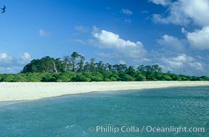
Rose islet and Pisonia trees.
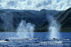
Humpback whale competitive group, surfacing and blowing.
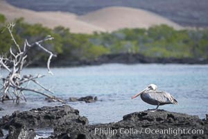
Brown pelican.
Wolf Island is the largest of the islands in the distant northern island group of the Galapagos archipelago, is home to hundreds of thousands of seabirds. Vast schools of sharks and fish inhabit the waters surrounding Wolf Island.
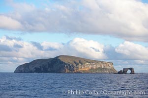
Darwin Island, with Darwins Arch on the right. Darwin Island is the northernmost of the Galapagos Islands and is home to enormous numbers of seabirds.
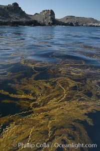
Kelp fronds grow upward from the reef below to reach the ocean surface and spread out to form a living canopy.
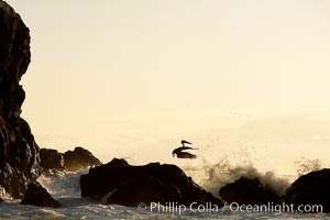
Brown pelican, waves, rocks and cliffs, sunset.
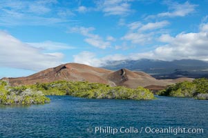
Mangrove shoreline. Mangroves have vertical branches, pheumatophores, that serve to filter out salt and provide fresh water to the leaves of the plant. Many juvenile fishes and young marine animals reside in the root systems of the mangroves. Punta Albemarle.
Boat Lammer Law lies at anchor near Isabella Island.
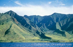
West Maui mountains rise above the coast of Maui, with clouds flanking the ancient eroded remnants of a volcano.
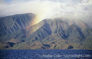
West Maui mountains rise above the coast of Maui, with clouds flanking the ancient eroded remnants of a volcano.
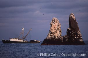
Illegal fishing at Roca Partida, Revillagigedos.
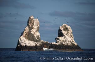
Roca Partida, a small remote seamount in the Revillagigedos.
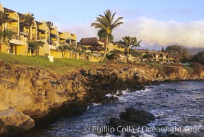
Napili Point Resort, west Maui.
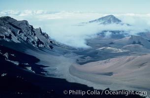
Haleakala volcano crater.
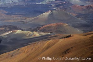
Haleakala volcano crater.
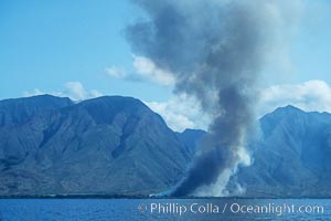
West Maui and smoke from burning cut sugar cane. Cane fields are often burned to clear cane cuttings, which produces huge amounts of smoke and ash.
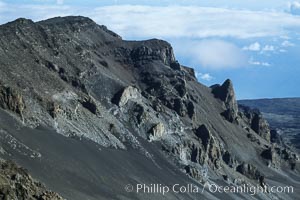
Haleakala Volcano crater slope.
Isabella Island.
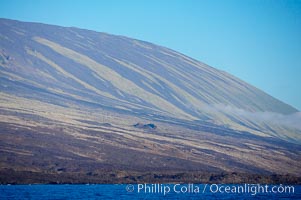
Socorro Island, sea cliffs and hills.
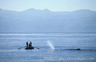
Sperm whale blows in front of Tokyo Broadcasting System film crew.
Molokai summit and cloud, viewed from west Maui.
Molokai and water pools, viewed from west Maui.