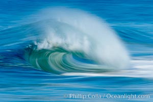
Breaking wave, fast motion and blur. The Wedge, Newport Beach.
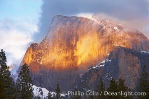
Half Dome and storm clouds at sunset, viewed from Sentinel Bridge.
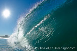
Cresting wave and morning sun, Carlsbad, California.
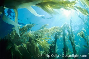
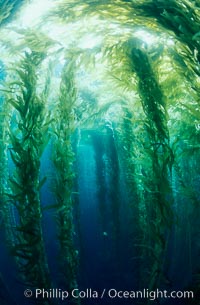
A kelp forest with sunbeams passing through kelp fronds. Macrocystis pyrifera, San Clemente Island, California.
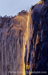
Horsetail Falls backlit by the setting sun as it cascades down the face of El Capitan, February, Yosemite Valley.
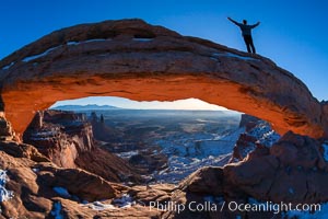
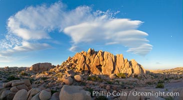
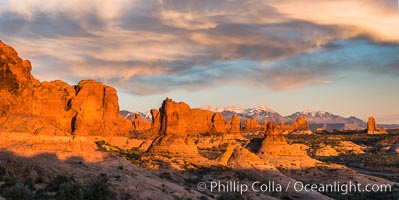
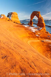
Atop Mesa Arch, Canyonlands National Park, Utah
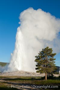
Old Faithful, Yellowstone National Park, Wyoming.
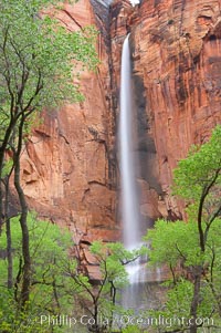
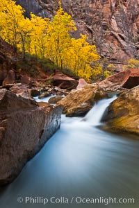
Waterfall at Temple of Sinawava during peak flow following spring rainstorm. Zion Canyon.
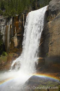
Vernal Falls at peak flow in late spring, with a rainbow appearing in the spray of the falls. Yosemite National Park.
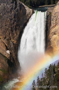
A rainbow appears in the mist of the Lower Falls of the Yellowstone River. At 308 feet, the Lower Falls of the Yellowstone River is the tallest fall in the park. This view is from Lookout Point on the North side of the Grand Canyon of the Yellowstone. When conditions are perfect in midsummer, a midmorning rainbow briefly appears in the falls.
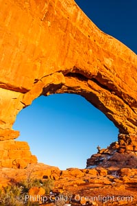
Hiker in North Window, sunset, western face. North Window is a natural sandstone arch 90 feet wide and 48 feet high. Arches National Park, Utah.
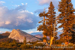
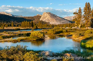
Lembert Dome and late afternoon clouds rise above Tuolumne Meadows in the High Sierra, catching the fading light of sunset.
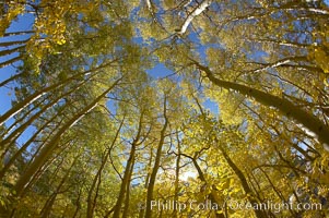
Aspen trees display Eastern Sierra fall colors, Lake Sabrina, Bishop Creek Canyon.
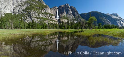
Yosemite Falls at peak flow in late spring, viewed from Cooks Meadow.
Paradise Falls tumble over rocks in Paradise Creek.
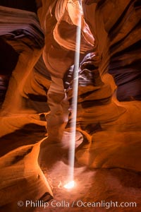
Light Beam in Upper Antelope Slot Canyon. Thin shafts of light briefly penetrate the convoluted narrows of Upper Antelope Slot Canyon, sending piercing beams through the sandstone maze to the sand floor below.
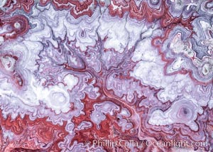
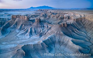
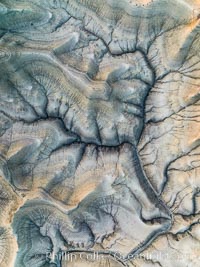
The Tree of Eons, a spectacular dendritic formation in the Bentonic Hills of Utah. Fantastic colorful sedimentary patterns, ancient Bentonite layers are exposed through erosion in the Utah Badlands. The Bentonite Hills are composed of the Brushy Basin shale member of the Morrison Formation. This layer was formed during Jurassic times when mud, silt, fine sand, and volcanic ash were deposited in swamps and lakes. Photographed just before sunrise with soft pre-dawn illumination. Aerial panoramic photograph.
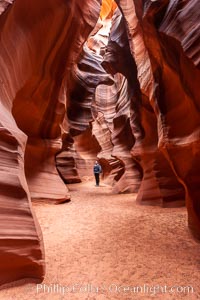
A hiker admiring the striated walls and dramatic light within Antelope Canyon, a deep narrow slot canyon formed by water and wind erosion.
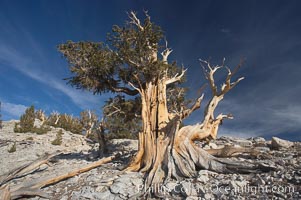
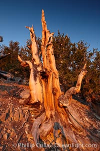
Bristlecone pine displays its characteristic gnarled, twisted form as it rises above the arid, dolomite-rich slopes of the White Mountains at 11000-foot elevation. Patriarch Grove, Ancient Bristlecone Pine Forest.
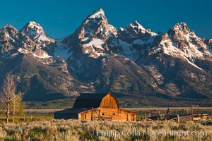
John Moulton barn at sunrise with Teton Range, on Mormon Row in Grand Teton National Park, Wyoming.
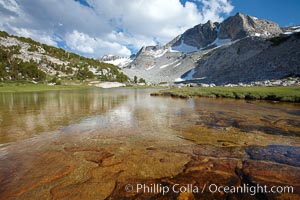
Townsley Lake (10396'), a beautiful alpine lake sitting below blue sky, clouds and Fletcher Peak (right), lies amid the Cathedral Range of glacier-sculpted granite peaks in Yosemite's high country, near Vogelsang High Sierra Camp.
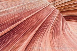
The Wave, an area of fantastic eroded sandstone featuring beautiful swirls, wild colors, countless striations, and bizarre shapes set amidst the dramatic surrounding North Coyote Buttes of Arizona and Utah. The sandstone formations of the North Coyote Buttes, including the Wave, date from the Jurassic period. Managed by the Bureau of Land Management, the Wave is located in the Paria Canyon-Vermilion Cliffs Wilderness and is accessible on foot by permit only.
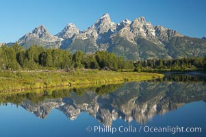
The Teton Range is reflected in the glassy waters of the Snake River at Schwabacher Landing, Grand Teton National Park, Wyoming.
The Virgin River flows by autumn cottonwood trees, part of the Virgin River Narrows. This is a fantastic hike in fall with the comfortable temperatures, beautiful fall colors and light crowds.
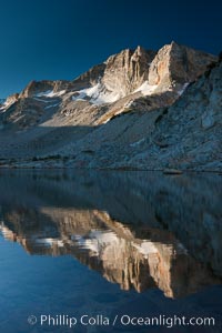
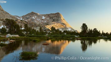
Cathedral Range peaks reflected in the still waters of Townsley Lake at sunrise, high country near Vogelsang High Sierra Camp, Yosemite National Park.
Yosemite Falls reflected in flooded meadow. The Merced River floods its banks in spring, forming beautiful reflections of Yosemite Falls. Yosemite National Park.
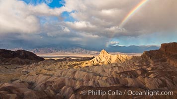
Rainbow and clearing storm clouds, sunrise light on Manly Beacon, Zabriskie Point, Death Valley National Park, California.
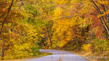
Blue Ridge Parkway Fall Colors, Asheville, North Carolina
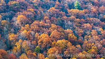
Blue Ridge Parkway Fall Colors, Asheville, North Carolina
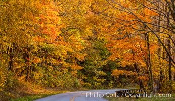
Blue Ridge Parkway Fall Colors, Asheville, North Carolina
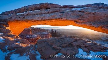
Mesa Arch at Sunrise, Canyonlands National Park, Utah
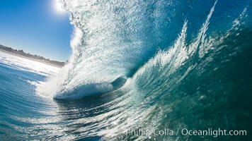
Heaving tube, wave breaks across the morning sun, Carlsbad, California.
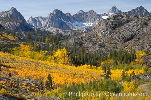
Aspen trees cover Bishop Creek Canyon above Aspendel.
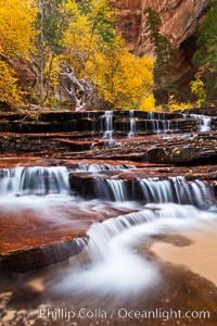
Archangel Falls in autumn, near the Subway in North Creek Canyon, with maples and cottonwoods turning fall colors.
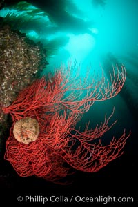
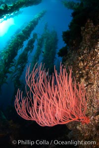
Bryozoan grows on a red gorgonian on rocky reef, below kelp forest, underwater. The red gorgonian is a filter-feeding temperate colonial species that lives on the rocky bottom at depths between 50 to 200 feet deep. Lophogorgia chilensis, California.
The Milky Way galaxy arcs over Arch Rock in Joshua Tree National Park.
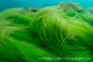
Abstract surfgrass in motion, underwater movement and blur, San Clemente Island, California.
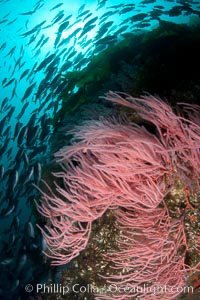
A school of blacksmith swims over a red gorgonian growing on a rocky reef. California.
Vogelsang Peak (11516') at sunset, reflected in a small creek near Vogelsang High Sierra Camp in Yosemite's high country.
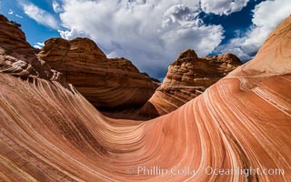
The Wave in the North Coyote Buttes, an area of fantastic eroded sandstone featuring beautiful swirls, wild colors, countless striations, and bizarre shapes set amidst the dramatic surrounding North Coyote Buttes of Arizona and Utah. The sandstone formations of the North Coyote Buttes, including the Wave, date from the Jurassic period. Managed by the Bureau of Land Management, the Wave is located in the Paria Canyon-Vermilion Cliffs Wilderness and is accessible on foot by permit only.
Dawn over the Skyline Rim, Factory Bench and Lower Blue Hills, Utah. The Henry Mountains are in the distance.
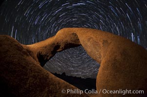
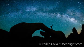
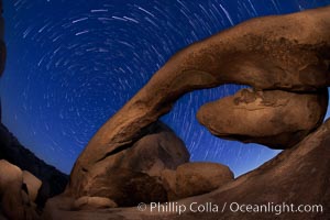
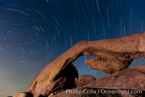
Mobius Arch in the Alabama Hills, seen here at night with swirling star trails formed in the sky above due to a long time exposure.
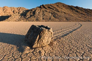
Sailing stone on the Racetrack Playa. The sliding rocks, or sailing stones, move across the mud flats of the Racetrack Playa, leaving trails behind in the mud. The explanation for their movement is not known with certainty, but many believe wind pushes the rocks over wet and perhaps icy mud in winter
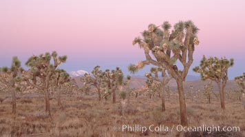
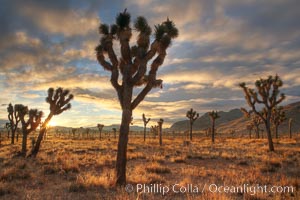
Joshua Trees at dawn, Yucca brevifolia, Joshua Tree National Park.
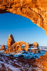
Sunrise light on Turret Arch viewed through North Window, winter.
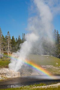
A rainbow appears in the spray of Riverside Geyser as it erupts over the Firehole River. Riverside is a very predictable geyser. Its eruptions last 30 minutes, reach heights of 75 feet and are usually spaced about 6 hours apart. Upper Geyser Basin.
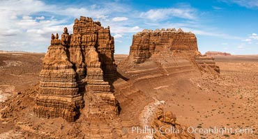
Molly's Castle, aerial view, Goblin Valley State Park. Curtis Formation whiteish caprock is on top, with reddish Entrada Sandstone below, both of Jurassic era. Molly's castle lies in the San Rafael desert near Goblin Valley, and drains into the Colorado River watershed. Aerial panoramic photograph.
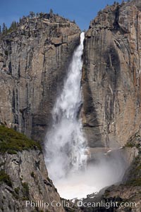
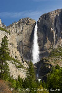
Upper Yosemite Falls near peak flow in spring. Yosemite Falls, at 2425 feet tall (730m) is the tallest waterfall in North America and fifth tallest in the world. Yosemite Valley.
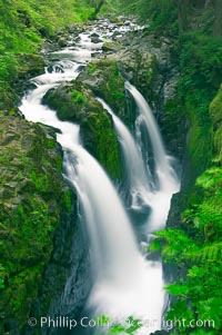
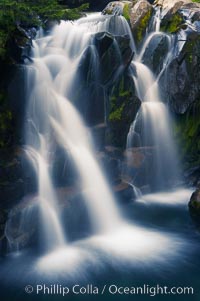
Sol Duc Falls. Sol Duc Falls is one of the largest and most beautiful waterfalls in Olympic National Park, seen here from a bridge that crosses the canyon just below the falls. Surrounding the falls is an old-growth forest of hemlocks and douglas firs, some of which are three hundred years in age.
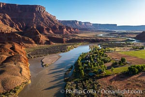
Colorado River and Sorrel River Ranch, Moab, Utah. The Dome Plateau rises over the river on the left.
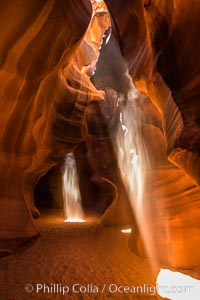
Light Beam in Upper Antelope Slot Canyon. Thin shafts of light briefly penetrate the convoluted narrows of Upper Antelope Slot Canyon, sending piercing beams through the sandstone maze to the sand floor below.
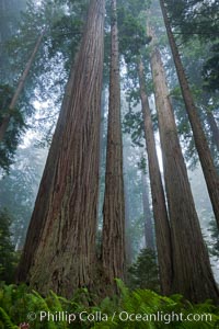
Coastal Redwoods, Northern California
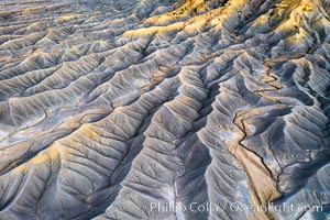
Erosion patterns in the Utah Badlands, aerial abstract photo.
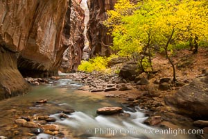
The Virgin River flows by autumn cottonwood trees, part of the Virgin River Narrows. This is a fantastic hike in fall with the comfortable temperatures, beautiful fall colors and light crowds.
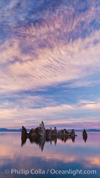
Tufa and clouds reflected in the still waters of Mono Lake.
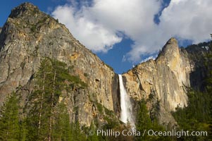
Bridalveil Falls at sunset, with clouds and blue sky in the background. Bridalveil Falls in Yosemite drops 620 feet (188 m) from a hanging valley to the floor of Yosemite Valley.
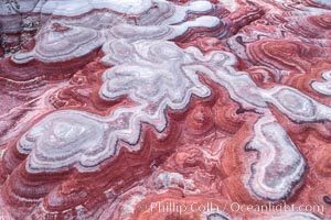
Fantastic colorful sedimentary patterns of Bentonite layers, seen as striations exposed in the Utah Badlands. The Bentonite Hills are composed of the Brushy Basin shale member of the Morrison Formation formed during Jurassic times when mud, silt, fine sand, and volcanic ash were deposited in swamps and lakes into layers, now revealed through erosion. Aerial photograph.
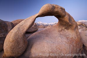
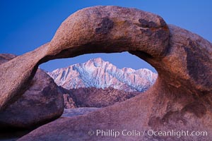
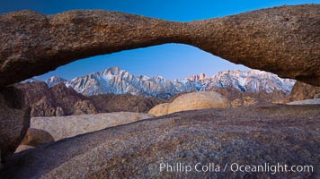
Mobius Arch at sunrise, with Mount Whitney (the tallest peak in the continental United States), Lone Pine Peak and snow-covered Sierra Nevada Range framed within the arch. Mobius Arch is a 17-foot-wide natural rock arch in the scenic Alabama Hills Recreational Area near Lone Pine, California.
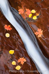
Water rushes through a narrow crack, in the red sandstone of Zion National Park, with fallen autumn leaves.
Sunrise in Joshua Tree National Park.
Sunset and boulders, Joshua Tree National Park, panorama.
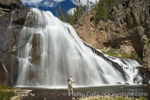
Fly fishing below Gibbon Falls. This flyfisherman hiked up the Gibbon River to reach the foot of Gibbon Falls.
Ancient bristlecone pine tree, rising above the arid, dolomite-rich slopes of the Schulman Grove in the White Mountains at an elevation of 9500 above sea level, along the Methuselah Walk. The oldest bristlecone pines in the world are found in the Schulman Grove, some of them over 4700 years old. Ancient Bristlecone Pine Forest.
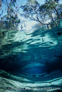
Underwater landscape, Three Sisters Springs, Florida.
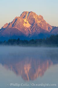
Mount Moran rises above the Snake River at Oxbow Bend, Grand Teton National Park.
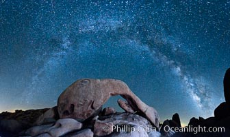
The Milky Way galaxy arcs above Arch Rock in Joshua Tree National Park in this high resolution panoramic photograph.
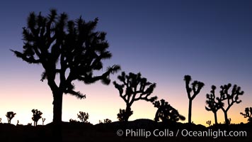
Joshua Trees silhouetted against predawn sunrise light.
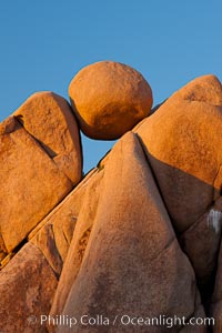
Boulders and sunset in Joshua Tree National Park. The warm sunlight gently lights unusual boulder formations at Jumbo Rocks in Joshua Tree National Park, California.
Star trails and Arch Rock, Joshua Tree National Park
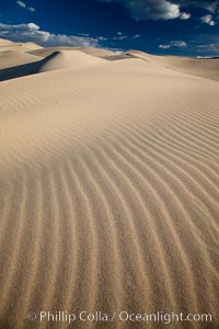
Eureka Dunes. The Eureka Valley Sand Dunes are California's tallest sand dunes, and one of the tallest in the United States. Rising 680' above the floor of the Eureka Valley, the Eureka sand dunes are home to several endangered species, as well as ""singing sand"" that makes strange sounds when it shifts. Located in the remote northern portion of Death Valley National Park, the Eureka Dunes see very few visitors.
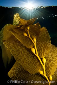
Kelp fronds and pneumatocysts. Pneumatocysts, gas-filled bladders, float the kelp plant off the ocean bottom toward the surface and sunlight, where the leaf-like blades and stipes of the kelp plant grow fastest. Giant kelp can grow up to 2' in a single day given optimal conditions. Epic submarine forests of kelp grow throughout California's Southern Channel Islands.
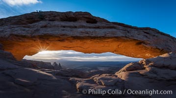
Mesa Arch Sunrise, Canyonlands National Park, Utah
Snow-covered Lone Pine Peak framed within Moebius Arch, dawn.
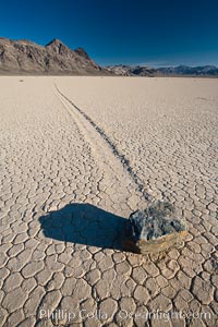
A sliding rock of the Racetrack Playa. The sliding rocks, or sailing stones, move across the mud flats of the Racetrack Playa, leaving trails behind in the mud. The explanation for their movement is not known with certainty, but many believe wind pushes the rocks over wet and perhaps icy mud in winter.
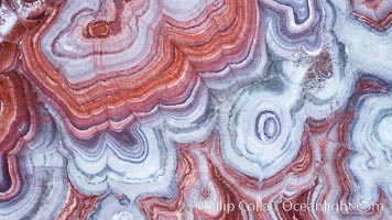
Fantastic colorful sedimentary patterns, Bentonite layers are seen as striations exposed in the Utah Badlands, part of the Chinle Formation formed during the Upper Triassic Period. Aerial photograph.
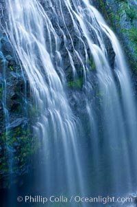
Narada Falls cascades down a cliff, with the flow blurred by a time exposure. Narada Falls is a 188 foot (57m) waterfall in Mount Rainier National Park.
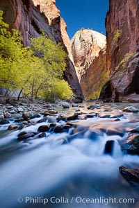
Yellow cottonwood trees in autumn, fall colors in the Virgin River Narrows in Zion National Park.
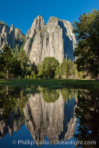
Cathedral Rocks is reflected at sunrise in a sidewater of the Merced River, Yosemite National Park, California.
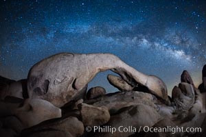
The Milky Way galaxy echoes the shape of Arch Rock in Joshua Tree National Park in this, night-time star field exposure.
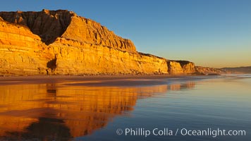
Torrey Pines State Beach, sandstone cliffs rise above the beach at Torrey Pines State Reserve.
Star trails and Arch Rock, Joshua Tree National Park.
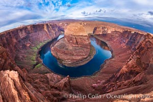
Horseshoe Bend. The Colorado River makes a 180-degree turn at Horseshoe Bend. Here the river has eroded the Navajo sandstone for eons, digging a canyon 1100-feet deep.
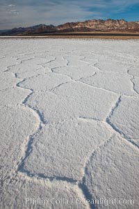
Salt polygons. After winter flooding, the salt on the Badwater Basin playa dries into geometric polygonal shapes.
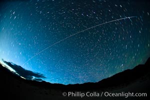
The International Space Station flys over Death Valley shortly after sunset.
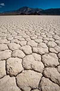
Racetrack Playa, an ancient lake now dried and covered with dessicated mud.
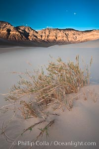
Eureka dune grass, and rare and federally endangered species of grass endemic to the Eureka Valley and Eureka Sand Dunes. The Last Chance mountains, lit by sunset, as visible in the distance. Swallenia alexandrae, a perennial grass, grows only in the southern portion of Eureka Valley Sand Dunes, in Inyo County, California.
Mount Whitney and Lone Pine Peak are framed by Lathe Arch in the Alabama Hills at sunrise, California.
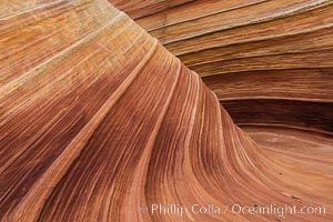
The Wave in the North Coyote Buttes, an area of fantastic eroded sandstone featuring beautiful swirls, wild colors, countless striations, and bizarre shapes set amidst the dramatic surrounding North Coyote Buttes of Arizona and Utah. The sandstone formations of the North Coyote Buttes, including the Wave, date from the Jurassic period. Managed by the Bureau of Land Management, the Wave is located in the Paria Canyon-Vermilion Cliffs Wilderness and is accessible on foot by permit only.
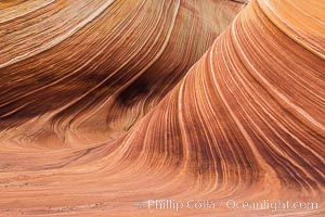
The Wave in the North Coyote Buttes, an area of fantastic eroded sandstone featuring beautiful swirls, wild colors, countless striations, and bizarre shapes set amidst the dramatic surrounding North Coyote Buttes of Arizona and Utah. The sandstone formations of the North Coyote Buttes, including the Wave, date from the Jurassic period. Managed by the Bureau of Land Management, the Wave is located in the Paria Canyon-Vermilion Cliffs Wilderness and is accessible on foot by permit only.
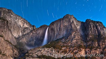
Star trails appear over Yosemite Falls in this 40 minute time exposure, Yosemite Valley, California.
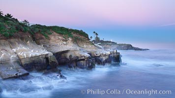
Earth Shadow lies over Point La Jolla at dawn.
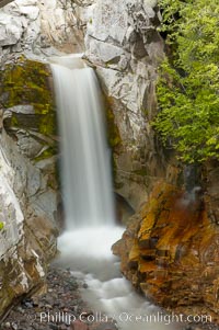
Christine Falls is a 69 foot (21m) waterfall in Mount Rainier. The lower section of Christine Falls is known for the bridge that spans across it.
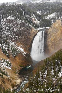
Snow covers the rocks and cliffs around Lower Yellowstone Falls in winter. At 308 feet, the Lower Falls of the Yellowstone River is the tallest fall in the park. This view is from Lookout Point on the North side of the Grand Canyon of the Yellowstone.
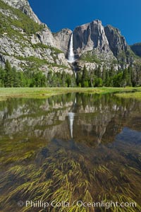
Upper Yosemite Falls is reflected in a flooded meadow created by heavy spring water levels in the Merced River, Yosemite National Park, California.
Sunset over Garden of the Gods, Arches National Park
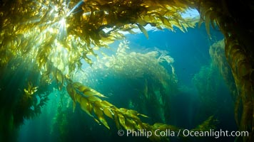
A view of an underwater forest of giant kelp. Giant kelp grows rapidly, up to 2' per day, from the rocky reef on the ocean bottom to which it is anchored, toward the ocean surface where it spreads to form a thick canopy. Myriad species of fishes, mammals and invertebrates form a rich community in the kelp forest. Lush forests of kelp are found through California's Southern Channel Islands.
Lower Blue Hills Badlands, sunrise, Utah
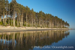
Ruby Beach, sunset lights up the trees along the beach.
Kelp canopy.
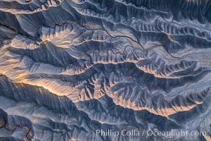
Erosion patterns in the Utah Badlands, aerial abstract photo.
La Jolla Cove and earth shadow at dawn. Just before sunrise the shadow of the Earth can seen as the darker sky below the pink sunrise
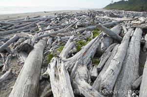
Enormous driftwood logs stack up on the wide flat sand beaches at Kalaloch.
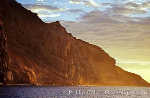
East face and shoreline of southernmost morro, daybreak.
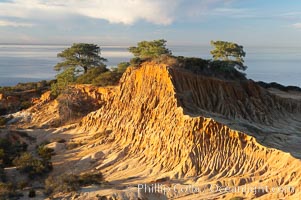
Broken Hill with the Pacific Ocean in the distance. Broken Hill is an ancient, compacted sand dune that was uplifted to its present location and is now eroding.
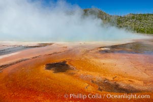
Grand Prismatic Spring displays brilliant colors along its edges, created by species of thermophilac (heat-loving) bacteria that thrive in narrow temperature ranges. The outer orange and red regions are the coolest water in the spring, where the overflow runs off. Midway Geyser Basin.
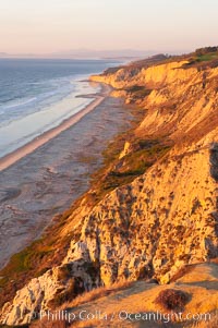
Black's Beach and Sandstone cliffs at Torrey Pines State Park, viewed from high above the Pacific Ocean near the Indian Trail.
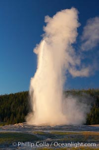
Old Faithful geyser at sunset, at peak eruption.
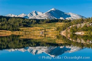
Mammoth Peak and alpine meadows in the High Sierra are reflected in Tioga Lake at sunrise. This spectacular location is just a short walk from the Tioga Pass road. Near Tuolumne Meadows and Yosemite National Park.
The Tuolumne River flows serenely through Tuolumne Meadows in the High Sierra. Lembert Dome is seen in the background.
Red gorgonian on rocky reef, below kelp forest, oriented at right angles to prevailing water currents to capture plankton drifting by.
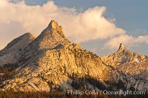
Unicorn Peak at sunset, seen from Tuolumne Meadows. Cockscomb Peak rises in the distance.
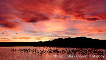
Sunset at Bosque del Apache National Wildlife Refuge, with sandhill cranes silhouetted in reflection in the calm pond. Spectacular sunsets at Bosque del Apache, rich in reds, oranges, yellows and purples, make for striking reflections of the thousands of cranes and geese found in the refuge each winter.
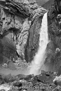
Lower Yosemite Falls in spring.
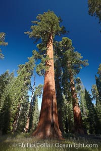
A giant sequoia tree soars skyward from the forest floor. Sequoiadendron giganteum. Mariposa Grove, Yosemite National Park.
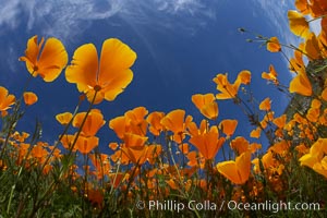
California poppy plants viewed from the perspective of a bug walking below the bright orange blooms.
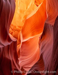
Lower Antelope Canyon, a deep, narrow and spectacular slot canyon lying on Navajo Tribal lands near Page, Arizona.
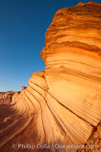
The Great Wall. Sunset on sandstone fins, Navajo Tribal Lands, Arizona.
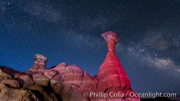
Milky Way and Toadstool Hoodoos, Grand Staircase - Escalante National Monument.
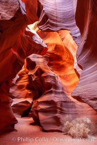
Fantastic light in Upper Antelope Slot Canyon, Arizona.
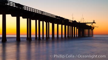
Research pier at Scripps Institution of Oceanography SIO, sunset.
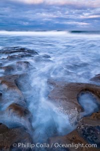
Waves wash over sandstone reef, clouds and sky, Windandsea, La Jolla, California.
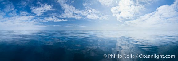
Ocean surface panorama, glassy calm ocean water offshore of California, clouds and sky.
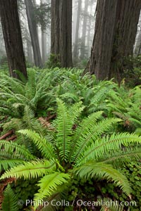
Ferns grow below coastal redwood and Douglas Fir trees, Lady Bird Johnson Grove, Redwood National Park. The coastal redwood, or simply 'redwood', is the tallest tree on Earth, reaching a height of 379' and living 3500 years or more. It is native to coastal California and the southwestern corner of Oregon within the United States, but most concentrated in Redwood National and State Parks in Northern California, found close to the coast where moisture and soil conditions can support its unique size and growth requirements.
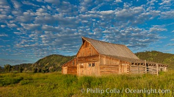
T.A. Moulton barn at sunrise, on Mormon Row in Grand Teton National Park, Wyoming.
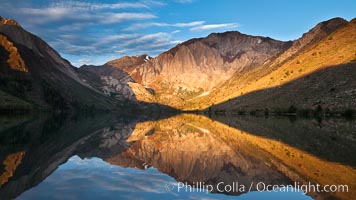
Convict Lake sunrise reflection, Sierra Nevada mountains.
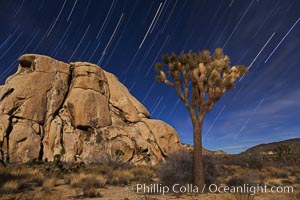
Joshua trees and star trails, moonlit night. The Joshua Tree is a species of yucca common in the lower Colorado desert and upper Mojave desert ecosystems.
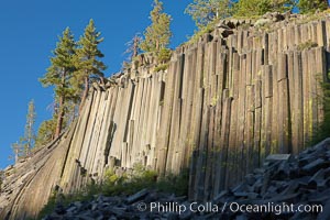
Devil's Postpile, a spectacular example of columnar basalt. Once molten and under great pressure underground, the lava that makes up Devil's Postpile cooled evenly and slowly, contracting and fracturing into polygonal-sided columns. The age of the formation is estimated between 100 and 700 thousand years old. Sometime after the basalt columns formed, a glacier passed over the formation, cutting and polishing the tops of the columns. The columns have from three to seven sides, varying because of differences in how quickly portions of the lava cooled.
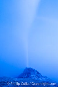
White Dome Geyser, rises to a height of 30 feet or more, and typically erupts with an interval of 15 to 30 minutes. It is located along Firehole Lake Drive.
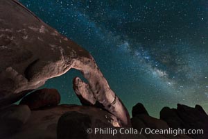
Arch Rock and Milky Way, Joshua Tree National Park.
Delicate Arch, Arches National Park, Utah.
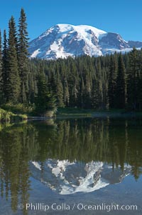
Mount Rainier rises above Reflection Lake, afternoon.
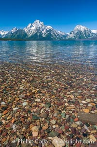
Rocky shallows in Jackson Lake with Mount Moran in the background, Grand Teton National Park.
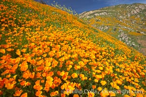
Explosion of California Poppies, San Diego.
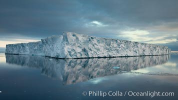
Incredible tabular iceberg, Paulet Island, Antarctica.
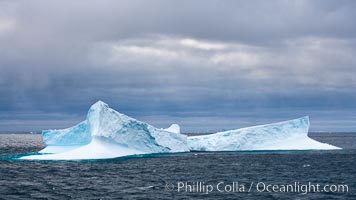
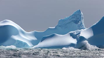
Iceberg, ocean, light and clouds. Light plays over icebergs and the ocean near Coronation Island.
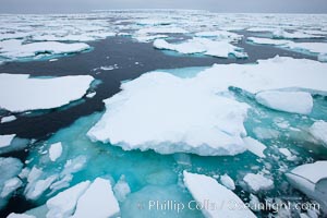
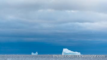
Pack ice, a combination of sea ice and pieces of icebergs, Weddell Sea.
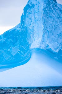
Iceberg detail, at sea among the South Orkney Islands.
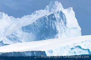
Iceberg detail, at sea among the South Orkney Islands.
Iceberg, ocean, light and clouds. Light plays over icebergs and the ocean near Coronation Island.
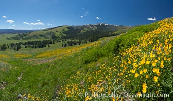
Wildflowers on Mount Washburn, on the north side of Dunraven Pass near Tower Junction.
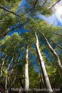
Aspen trees, with leaves changing from green to yellow in autumn, branches stretching skyward, a forest.
Iceberg, ocean, light and clouds. Light plays over icebergs and the ocean near Coronation Island.
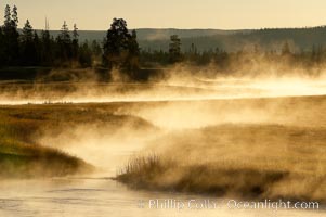
Madison River steaming in the cold air, Yellowstone National Park.
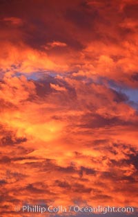
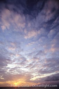
Sunset and cotton-candy clouds, storm is coming.
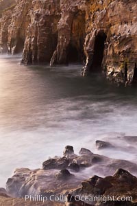
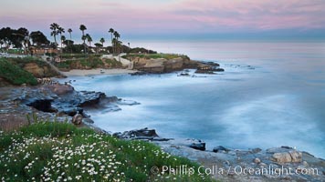
Sea Caves, the famous La Jolla sea caves lie below tall cliffs at Goldfish Point. Sunrise.
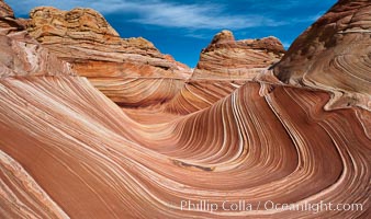
The Wave, an area of fantastic eroded sandstone featuring beautiful swirls, wild colors, countless striations, and bizarre shapes set amidst the dramatic surrounding North Coyote Buttes of Arizona and Utah. The sandstone formations of the North Coyote Buttes, including the Wave, date from the Jurassic period. Managed by the Bureau of Land Management, the Wave is located in the Paria Canyon-Vermilion Cliffs Wilderness and is accessible on foot by permit only.
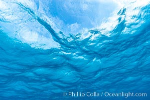
Sunlight and clouds are visible through the clear ocean waters of the Northern Bahamas.
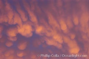
Sunset colors, abstract.
Sunset over the Auau Channel, Maui, Hawaii.
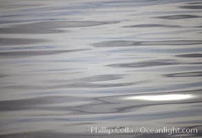
Steel gray reflections, abstract light patterns, Frederick Sound, Alaska.
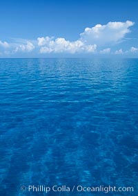
Clouds, ocean and sand plains, no land in sight. Bahamas.
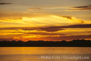
Sunset, clouds and ocean, Sea of Cortez.