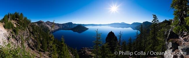
Panoramic photo of Crater Lake National Park

The Tree of Eons, a spectacular dendritic formation in the Bentonic Hills of Utah. Fantastic colorful sedimentary patterns, ancient Bentonite layers are exposed through erosion in the Utah Badlands. The Bentonite Hills are composed of the Brushy Basin shale member of the Morrison Formation. This layer was formed during Jurassic times when mud, silt, fine sand, and volcanic ash were deposited in swamps and lakes. Photographed just before sunrise with soft pre-dawn illumination. Aerial panoramic photograph.
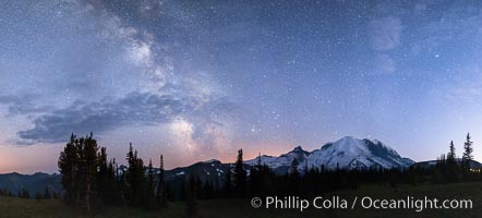
Milky Way and stars at night above Mount Rainier.
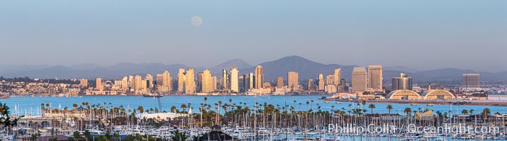
Full Moon over San Diego City Skyline, viewed from Point Loma. Mount San Miguel is in center while Lyons Peak lies to the left.
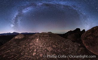
The Milky Way at Night over Sky Rock, panorama, spherical projection. Sky Rock petroglyphs near Bishop, California. Hidden atop an enormous boulder in the Volcanic Tablelands lies Sky Rock, a set of petroglyphs that face the sky. These superb examples of native American petroglyph artwork are thought to be Paiute in origin, but little is known about them.
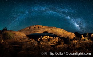
Panorama of the Milky Way over Mesa Arch.

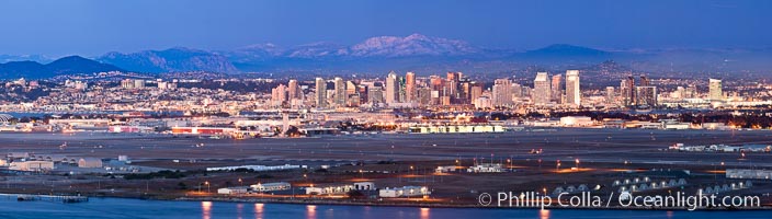
San Diego city skyline at sunrise, showing the buildings of downtown San Diego rising above San Diego Harbor, viewed from Harbor Island
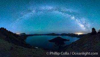
Milky Way and stars over Crater Lake at night. Panorama of Crater Lake and Wizard Island at night, Crater Lake National Park.
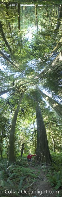
Ancient Douglas fir trees in Cathedral Grove, Pseudotsuga menziesii, MacMillan Provincial Park, Vancouver Island, British Columbia.
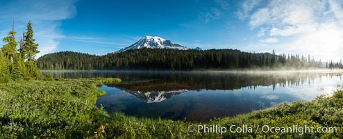
Mount Rainier is reflected in the calm waters of Reflection Lake, early morning
Dawn breaks over the San Diego harborfront skyline, enormous high resolution panorama
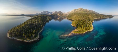
Emerald Bay Lake Tahoe, aerial panoramic photo of the mouth of the bay, early morning
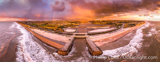
Batiquitos Lagoon and Ponto, stormy sunset, aerial panoramic photograph.
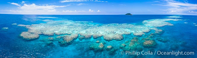
Aerial View of Namena Marine Reserve and Coral Reefs, Namena Island, Fiji
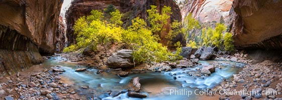
Fall Colors in the Virgin River Narrows, Zion National Park, Utah
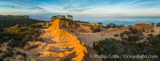
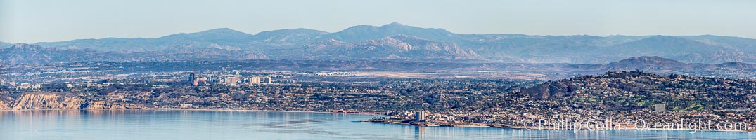
Panoramic photograph of Broken Hill and La Jolla from Torrey Pines at sunrise
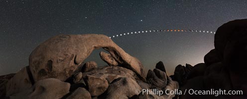
Lunar eclipse sequence and planet Mars over Arch Rock
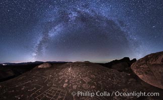
The Milky Way at Night over Sky Rock. Sky Rock petroglyphs near Bishop, California. Hidden atop an enormous boulder in the Volcanic Tablelands lies Sky Rock, a set of petroglyphs that face the sky. These superb examples of native American petroglyph artwork are thought to be Paiute in origin, but little is known about them.
Clearing storm clouds over Broken Hill, overlooking La Jolla and the Pacific Ocean, Torrey Pines State Reserve
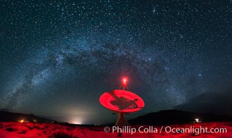
Owens Valley Radiotelescope Observatory 40 Meter Telescope and Milky Way, Night Panorama
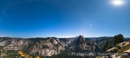
Half Dome and nighttime stars, viewed from Glacier Point.
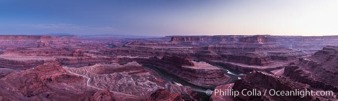
Sunset at Dead Horse Point Overlook, with the Colorado River flowing 2,000 feet below. 300 million years of erosion has carved the expansive canyons, cliffs and walls below and surrounding Deadhorse Point
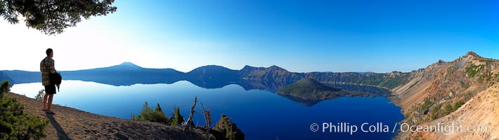
Self portrait at sunrise, panorama of Crater Lake, Crater Lake National Park, Oregon.
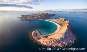
Isla San Francisquito, Aerial Photo, Sea of of Cortez

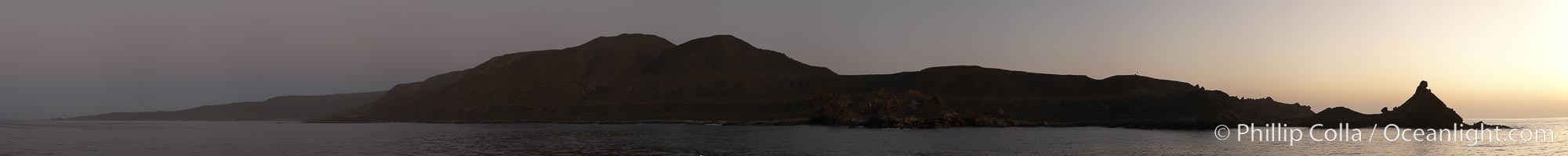
Guadalupe Island at sunrise, panorama. Volcanic coastline south of Pilot Rock and Spanish Cove, near El Faro lighthouse. Guadalupe Island (Isla Guadalupe), Baja California, Mexico.
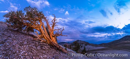
Ancient Bristlecone Pine Tree, storm front passing over White Mountains, sunset, panorama
Los Islotes Island, famous for its friendly colony of California sea lions, Espiritu Santo Biosphere Reserve, Sea of Cortez, Baja California, Mexico.
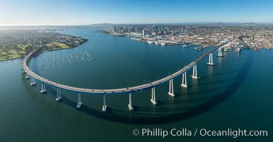
Panoramic Aerial Photo of San Diego Coronado Bay Bridge
San Diego City Skyline at Sunrise, High Resolution Panoramic Photo
San Diego Marriott Hotel and Marina, and Manchester Grand Hyatt Hotel (left) viewed from the San Diego Embarcadero Marine Park, sunrise
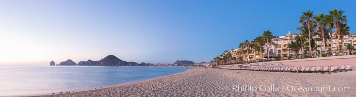
Sunrise on Medano Beach, on the coast of Cabo San Lucas, Mexico
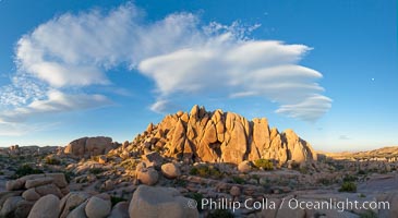
Sunset and boulders, Joshua Tree National Park, panorama.
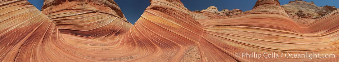
Panorama of the Wave, North Coyote Buttes, Arizona.
Stone Steps Beach at Sunset, Aerial Panorama, Encinitas, California
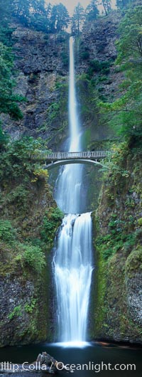
Multnomah Falls Panorama, Columbia River Gorge National Scenic Area, Oregon.
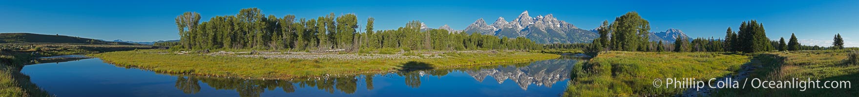
Panorama of the Teton Range reflected in the still waters of Schwabacher Landing, a sidewater of the Snake River, Grand Teton National Park, Wyoming.
Childrens Pool Aerial Panoramic Photo at Sunset, people enjoying the sunset on the sea wall and the protected beach, Coast Boulevard in the foreground, Mount Soledad in the distance
Sunset over Flat Rock on Torrey Pines State Beach
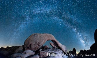
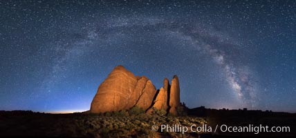
Milky Way and Stars over Broken Arch, Arches National Park, Utah
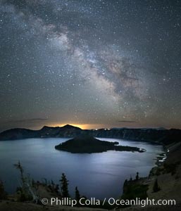
Milky Way and stars over Crater Lake at night. Panorama of Crater Lake and Wizard Island at night, Crater Lake National Park.
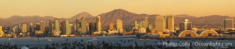
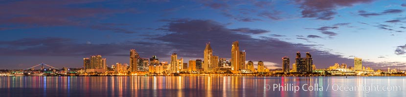
San Diego city skyline, showing the buildings of downtown San Diego rising above San Diego Harbor, viewed from Point Loma at sunset, with mountains of the Cleveland National Forest rising in the distance. A panoramic photograph, composite of six separate images. Mount San Miguel is on right and Lyons Peak to the left.
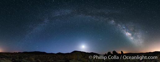
The Milky Way galaxy arcs above Arch Rock in Joshua Tree National Park in this high resolution panoramic photograph.
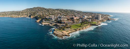
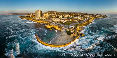
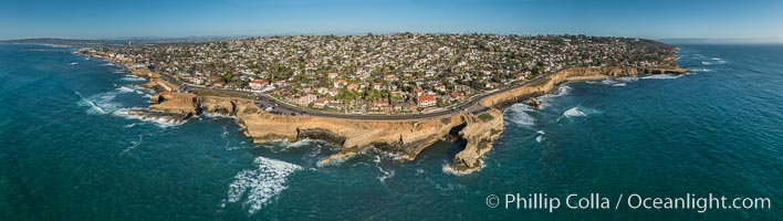
Aerial Panoramic Photo of Point La Jolla and La Jolla Cove, Boomer Beach, Scripps Park. Panoramic aerial photograph of La Jolla Cove and Scripps Parks (center), with La Jolla’s Mount Soledad rising above, La Jolla Shores and La Jolla Caves to the left and the La Jolla Coast with Children’s Pool (Casa Cove) to the right. The undersea reefs of Boomer Beach are seen through the clear, calm ocean waters. This extremely high resolution panorama will print 50″ high by 130″ long with no interpolation
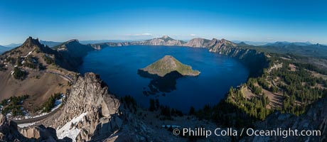
Panorama of Crater Lake from Watchman Lookout Station, panoramic picture. The Watchman Lookout Station No. 168 is one of two fire lookout towers in Crater Lake National Park in southern Oregon. For many years, National Park Service personnel used the lookout to watch for wildfires during the summer months. It is also a popular hiking destination because it offers an excellent view of Crater Lake and the surrounding area.
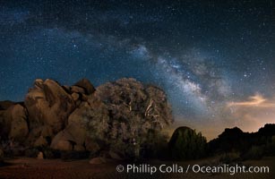
Live Oak and Milky Way, rocks and stars, Joshua Tree National Park at night
Joshua Tree National Park, Milky Way and Moon, Shooting Star, Comet Panstarrs, Impending Dawn.
Sandstone Fins at sunset, near Moab Utah. Fins like these form in sandstone and eventually some will continue to erode until natural stone arches, such as those in Arches National Park.
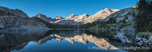
Panorama of Bear Creek Spire over Long Lake at Sunrise, Little Lakes Valley, John Muir Wilderness, Inyo National Forest

Oak Alley Plantation and its famous shaded tunnel of 300-year-old southern live oak trees (Quercus virginiana). The plantation is now designated as a National Historic Landmark.

San Diego city skyline at sunset, showing the buildings of downtown San Diego rising above San Diego Harbor, viewed from Harbor Island. A panoramic photograph, composite of four separate images.
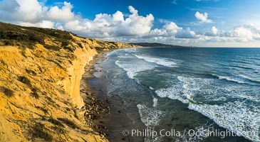
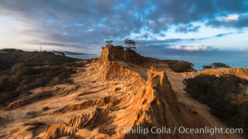
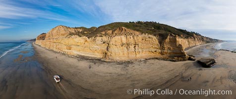
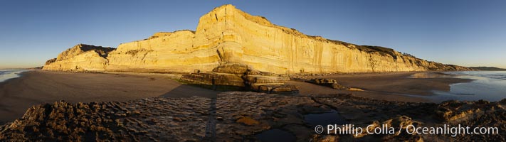
Torrey Pines cliffs
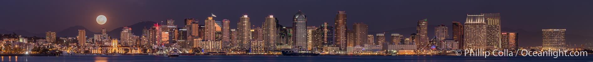
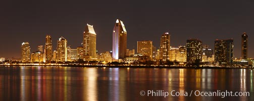
Full Moon rising over San Diego City Skyline, viewed from Harbor Island
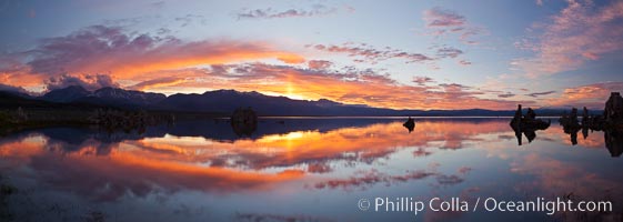
Sun pillar rises over the Sierra Nevada and this Mono Lake sunset, Sierra Nevada mountain range and tufas, clouds reflected in the still waters of Mono Lake.
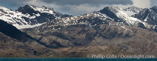
Mountains, glaciers and ocean, near Grytviken, South Georgia Island, Southern Ocean.
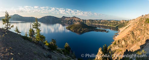
Crater Lake panoramic photograph. Panorama picture of Crater Lake National Park.
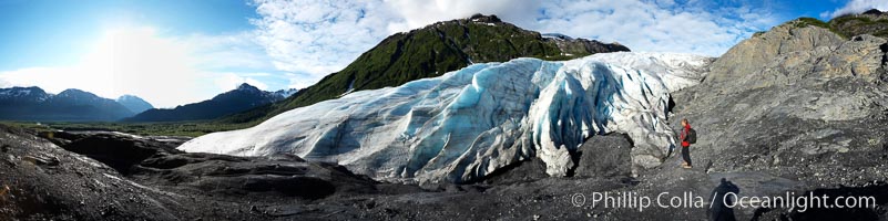
Exit Glacier Panorama, Kenai Fjords National Park, Alaska.
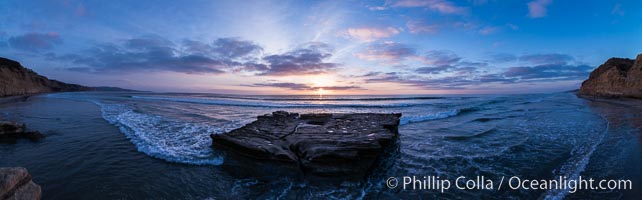
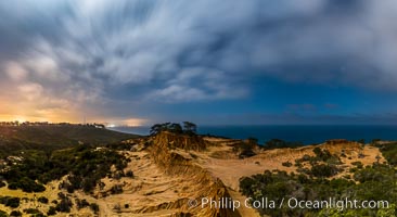
180-degree north-south panorama of Torrey Pines State Reserve seacliffs, with flat rock and Torrey Pines State Beach, photographed with a balloon aerial survey photography rig.
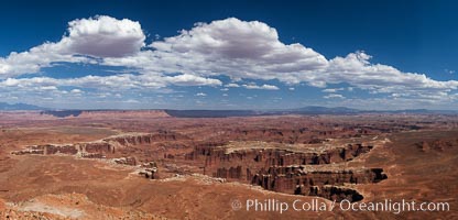
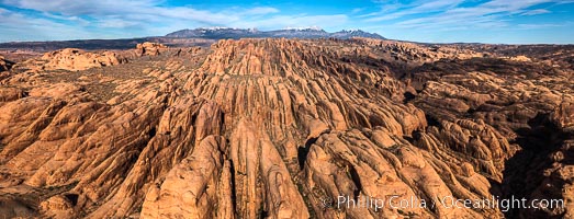
Canyonlands National Park panorama.
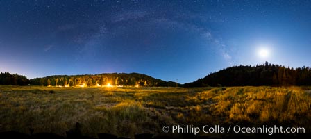
Moon and Milky Way over Palomar Mountain State Park
Moon and Stars over Pauma Valley, viewed from Palomar Mountain State Park
Aerial Panorama of La Jolla, University City, showing (from left) UCSD, University City, Scripps Institution of Oceanography, La Jolla Shores, Point La Jolla, Mount Soledad, in the background some of the mountains to the east of San Diego. The highest peak in the center of the panoram is Cuyamaca Peak (6512') while the rocky peak directly in front of it is El Cajon Mountain (3675').
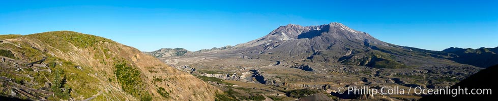
Mount St. Helens Panorama, Washington.
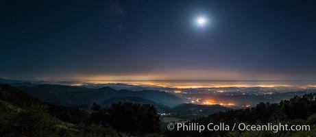
Torrey Pines at Night, Stars and Clouds, La Jolla's lights in the distance
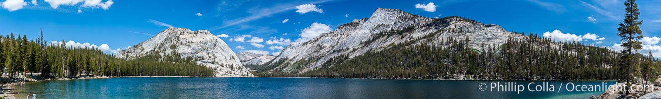
Panorama of Tenaya Lake, in Yosemite National Park's high country.
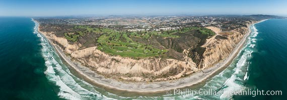
Aerial panorama of Blacks Beach, Torrey Pines Golf Course (south course), and views to La Jolla (south) and Carlsbad (north)
Aerial Panoramic Photo of Sunset Cliffs San Diego, Pappy's Point, Claiborne Cove
Sunset over Garden of the Gods, Arches National Park
San Diego city skyline at night, showing the buildings of downtown San Diego reflected in the still waters of San Diego Harbor, viewed from Coronado Island. A panoramic photograph, composite of seven separate images.
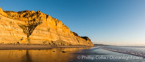
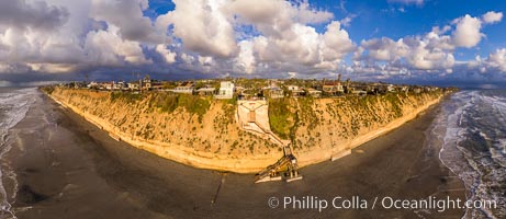
Torrey Pines cliffs at sunset
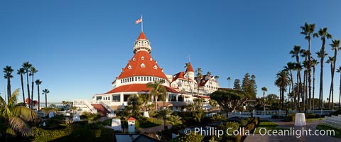
Hotel del Coronado, known affectionately as the Hotel Del. It was once the largest hotel in the world, and is one of the few remaining wooden Victorian beach resorts. It sits on the beach on Coronado Island, seen here with downtown San Diego in the distance. It is widely considered to be one of Americas most beautiful and classic hotels. Built in 1888, it was designated a National Historic Landmark in 1977.
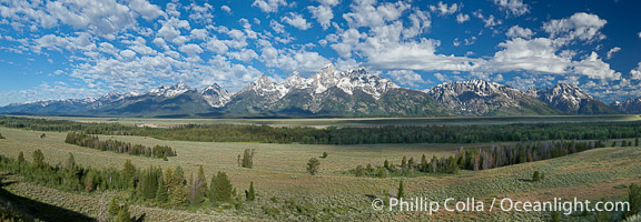
Panorama of the Teton Range, in Grand Teton National Park, Wyoming. The Teton peaks are seen together at center with Mount Moran to the right.
Milky Way over Sandstone Fins. Sandstone fins stand on edge. Vertical fractures separate standing plates of sandstone that are eroded into freestanding fins, that may one day further erode into arches.
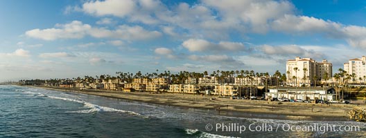
Oceanside beach at sunset viewed from Oceanside Pier

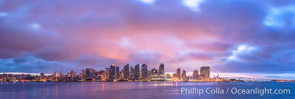
San Diego City Skyline viewed from Harbor Island, storm clouds at sunrise.

Ocean surface panorama, glassy calm ocean water offshore of California, clouds and sky.
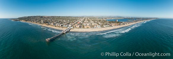
Aerial Panoramic Photo of Crystal Pier and Pacific Beach Coastline
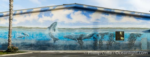
Underwater mural at Oceanside Pier

Ceiling detail, Opera de Paris, panorama

San Diego bay and skyline at sunrise, viewed from Coronado Island.
Guadalupe sunrise over the ocean, clouds and light, panorama

Grand Foyer and staircase, Opera de Paris

Salisbury Plain, South Georgia Island, Southern Ocean.
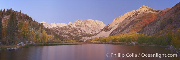
North Lake alpenglow sunrise, Autumn, panorama, Bishop Creek Canyon, California, USA
Torrey Pines State Beach, sandstone cliffs rise above the beach at Torrey Pines State Reserve, San Diego, California.
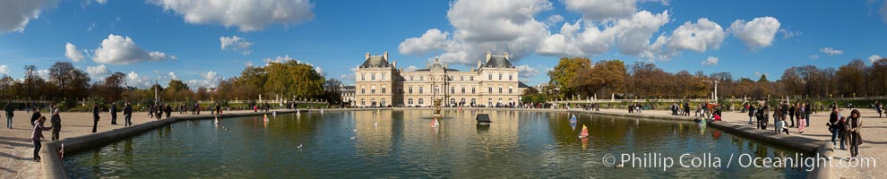
Jardin du Luxembourg. The Jardin du Luxembourg, or the Luxembourg Gardens, is the second largest public park in Paris located in the 6th arrondissement of Paris, France. The park is the garden of the French Senate, which is itself housed in the Luxembourg Palace.
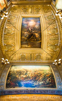
The Battle of the Nile, also known as the Battle of Aboukir Bay, in French as the Bataille d'Aboukir, panaramic photo showing wall and ceiling detail.

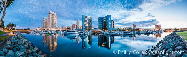
Panoramic photo of San Diego embarcadero, showing the San Diego Marriott Hotel and Marina (center), Roy's Restaurant (center) and Manchester Grand Hyatt Hotel (left) viewed from the San Diego Embacadero Marine Park.
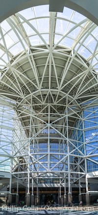
Los Angeles Convention Center, south hall, interior design exhibiting exposed space frame steel beams and glass enclosure.
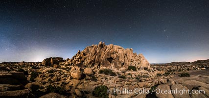
Jumbo Rocks and Stars at Night, landscape lit by a full moon
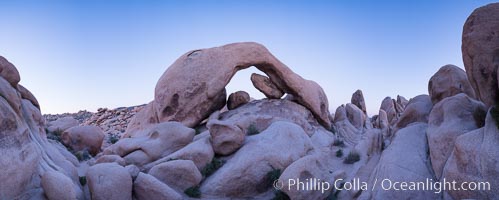
Panoramic image of Arch Rock at dusk
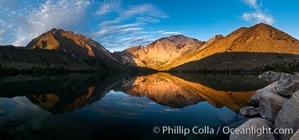
Convict Lake sunrise reflection, Sierra Nevada mountains.
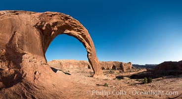
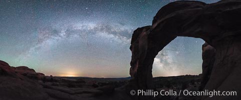
Corona Arch, Moab, Utah
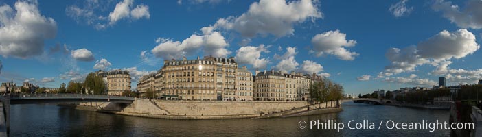
Ile Saint-Louis, is one of two natural islands in the Seine river, in Paris, France. The island is named after King Louis IX of France (Saint Louis). The island is connected to the rest of Paris by bridges to both banks of the river and by the Pont Saint Louis to the Ile de la Cite.
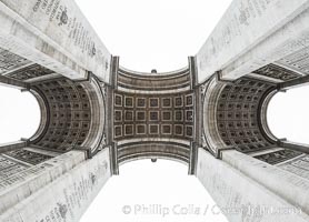
Arc de Triomphe. The Arc de Triomphe (Arc de Triomphe de l'Etoile) is one of the most famous monuments in Paris. It stands in the centre of the Place Charles de Gaulle (originally named Place de l'Etoile), at the western end of the Champs-Elysees. The Arc de Triomphe (in English: ""Triumphal Arch"") honors those who fought and died for France in the French Revolutionary and the Napoleonic Wars, with the names of all French victories and generals inscribed on its inner and outer surfaces. Beneath its vault lies the Tomb of the Unknown Soldier from World War I. The monument was designed by Jean Chalgrin in 1806, and its iconographic program pitted heroically nude French youths against bearded Germanic warriors in chain mail. It set the tone for public monuments, with triumphant patriotic messages. The monument stands 50 metres (164 ft) in height, 45 m (148 ft) wide and 22 m (72 ft) deep.
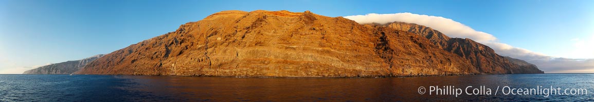
Guadalupe Island at sunrise, panorama. Volcanic coastline south of Pilot Rock and Spanish Cove, near El Faro lighthouse. Guadalupe Island (Isla Guadalupe), Baja California, Mexico.

The Hall of Mirrors, or Galerie des Glaces, is the central gallery of the Palace of Versailles and is renowned as being one of the most famous rooms in the world.
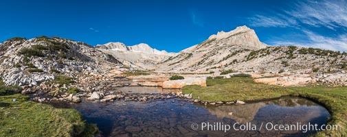
First View of Conness Lakes Basin with Mount Conness (12589' center) and North Peak (12242', right), Hoover Wilderness
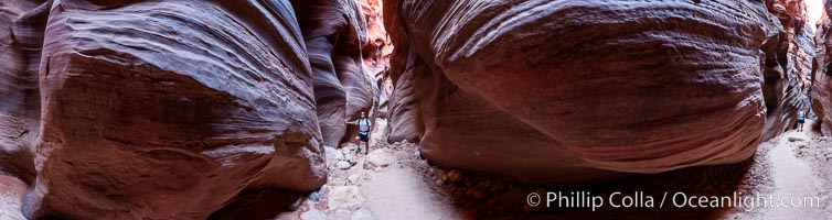
Panorama of a hiker in Buckskin Gulch, Paria Canyon-Vermilion Cliffs Wilderness, Arizona.
Panorama of Mount Laguna and San Diego Sunset, viewed from Fort Rosecrans National Cemetery, San Diego, California.
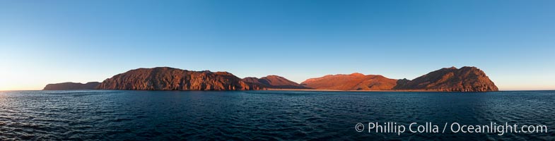
Isla Partida, Sea of Cortez coastal scenic panorama, near La Paz, Baja California, Mexico, part of the Espiritu Santo Biosphere Reserve.
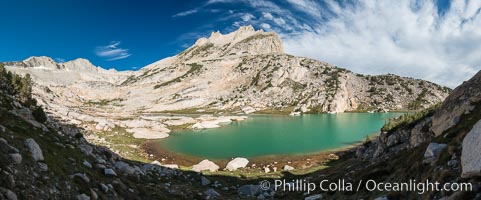
North Peak (12242', center), Mount Conness (left, 12589') and Conness Lake with its green glacial meltwater, Hoover Wilderness
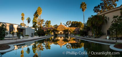
The Botanical Building in Balboa Park, San Diego. The Botanical Building, at 250 feet long by 75 feet wide and 60 feet tall, was the largest wood lath structure in the world when it was built in 1915 for the Panama-California Exposition. The Botanical Building, located on the Prado, west of the Museum of Art, contains about 2,100 permanent tropical plants along with changing seasonal flowers. The Lily Pond, just south of the Botanical Building, is an eloquent example of the use of reflecting pools to enhance architecture. The 193' by 43' foot pond and smaller companion pool were originally referred to as Las Lagunas de las Flores (The Lakes of the Flowers) and were designed as aquatic gardens. The pools contain exotic water lilies and lotus which bloom spring through fall
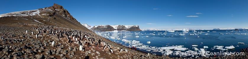
Adelie penguin colony (Pygoscelis adeliae), panoramic photograph, Devil Island, Antarctic Peninsula.

Fort Rosecrans National Cemetery.
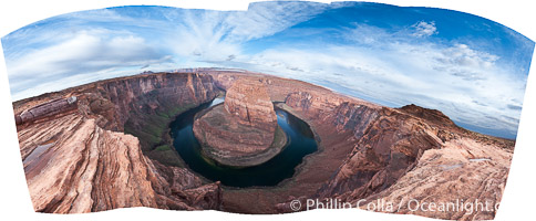
Panoramic photo of Horseshoe Bend, where the Colorado River makes a 180-degree turn at Horseshoe Bend. Here the river has eroded the Navajo sandstone for eons, digging a canyon 1100-feet deep, Arizona.
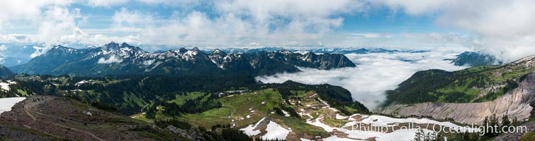
The Tatoosh Range viewed from the Skyline Trail, above Paradise Meadows on southern flank of Mount Rainier.
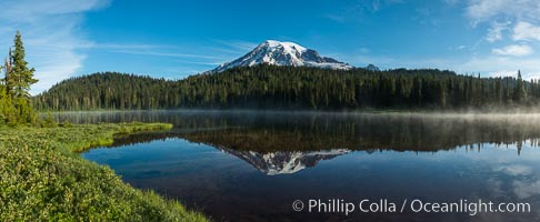
Mount Rainier is reflected in the calm waters of Reflection Lake, early morning
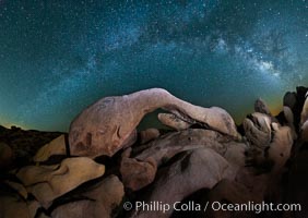
The Milky Way galaxy arches over Arch Rock on a clear evening in Joshua Tree National Park.
Panoramic photo of San Clemente Island at Pyramid Cove, sunrise. California.
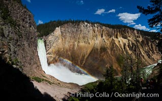
Panorama of Yellowstone Falls from Uncle Tom's Trail, Grand Canyon of the Yellowstone, Yellowstone National Park, Wyoming.
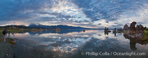
Mono Lake sunset, Sierra Nevada mountain range and tufas, clouds reflected in the still waters of Mono Lake.
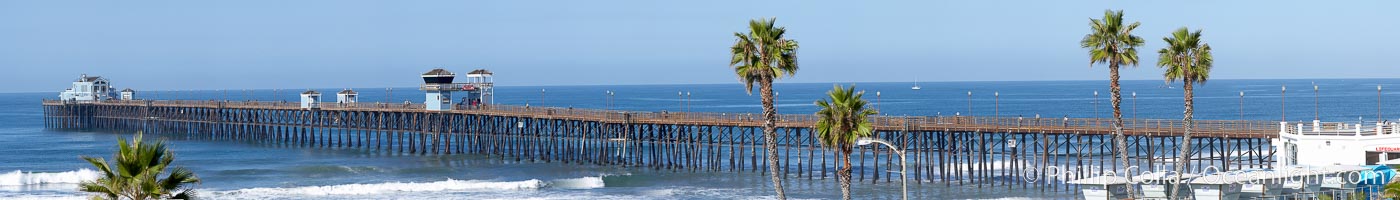
Oceanside Pier panorama.
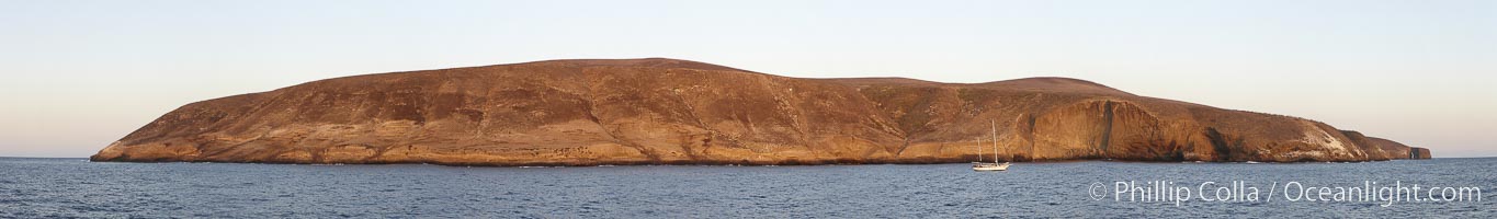
Panoramic photo of Santa Barbara Island, part of the Channel Islands National Marine Sanctuary, California.
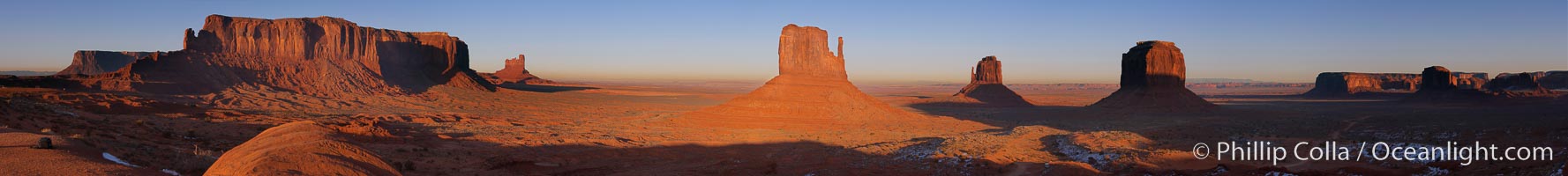
Panoramic photo of Monument Valley, Arizona.
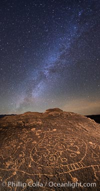
The Milky Way at Night over Sky Rock. Sky Rock petroglyphs near Bishop, California. Hidden atop an enormous boulder in the Volcanic Tablelands lies Sky Rock, a set of petroglyphs that face the sky. These superb examples of native American petroglyph artwork are thought to be Paiute in origin, but little is known about them.
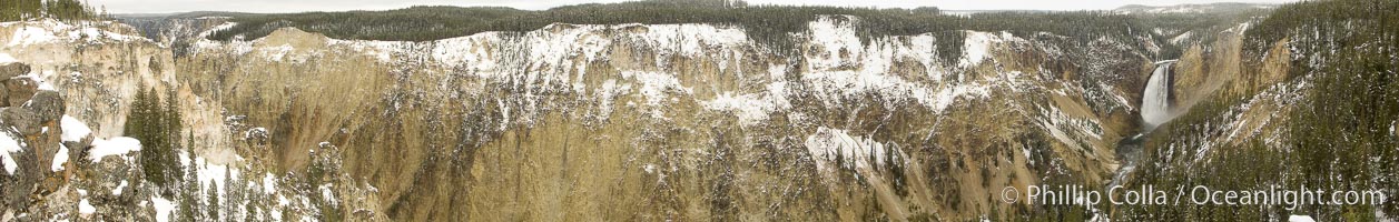
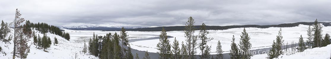
Grand Canyon of the Yellowstone, panorama, from Lookout Point, winter.
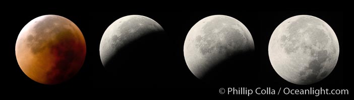
Lunar eclipse sequence, showing total eclipse (left) through full moon (right). While the moon lies in the full shadow of the earth (umbra) it receives only faint, red-tinged light refracted through the Earth's atmosphere. As the moon passes into the penumbra it receives increasing amounts of direct sunlight, eventually leaving the shadow of the Earth altogether. August 28, 2007.
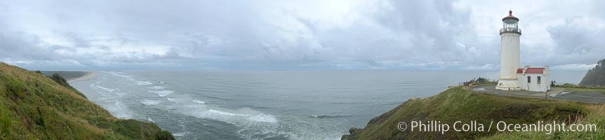
North Head Lighthouse Panorama, Washington.
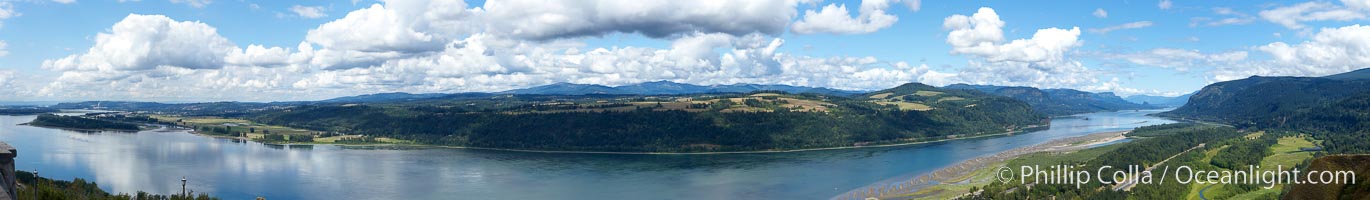
Panoramic view of the Columbia River as it flows through Columbia River Gorge Scenic Area, Oregon.
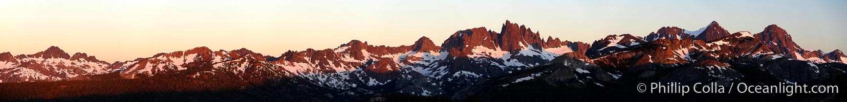
Panorama of the Minarets at sunrise, near Mammoth Mountain, California.
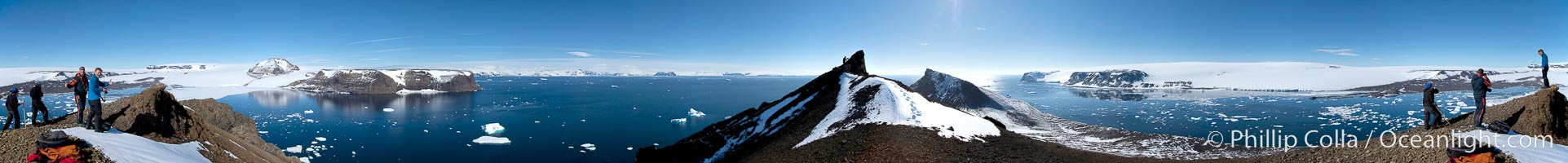
Panoramic photo of Devil Island, Antarctica.
Morro Bay panorama, Morro Bay, California.