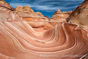
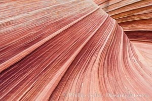
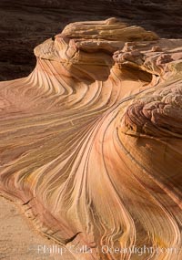
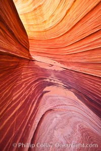
The Wave, North Coyote Buttes.
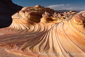
The Second Wave, North Coyote Buttes, Paria Canyon-Vermilion Cliffs Wilderness.
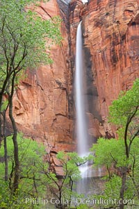
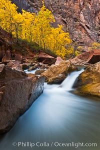
Waterfall at Temple of Sinawava during peak flow following spring rainstorm. Zion Canyon.
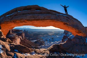
Atop Mesa Arch, Canyonlands National Park, Utah
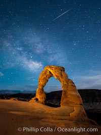
Milky Way galaxy and a Shooting Star over Delicate Arch at Night
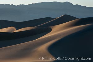
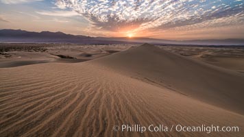
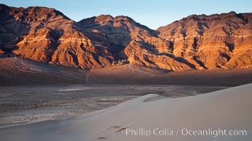
Tiny hikers atop Sand Dunes in Death Valley National Park, California. Near Stovepipe Wells lies a region of sand dunes, some of them hundreds of feet tall.
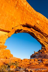
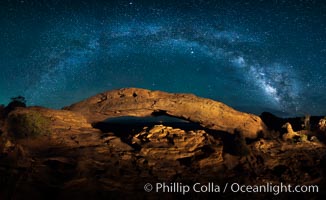
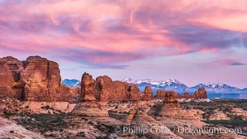
Hiker in North Window, sunset, western face. North Window is a natural sandstone arch 90 feet wide and 48 feet high. Arches National Park, Utah.
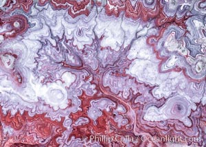
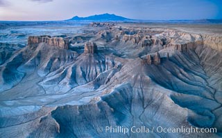
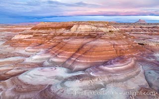
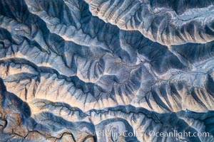
The Tree of Eons, a spectacular dendritic formation in the Bentonic Hills of Utah. Fantastic colorful sedimentary patterns, ancient Bentonite layers are exposed through erosion in the Utah Badlands. The Bentonite Hills are composed of the Brushy Basin shale member of the Morrison Formation. This layer was formed during Jurassic times when mud, silt, fine sand, and volcanic ash were deposited in swamps and lakes. Photographed just before sunrise with soft pre-dawn illumination. Aerial panoramic photograph.
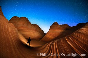
The Wave at Night, under a clear night sky full of stars. Photographer is illuminating the striated rocks with a small handheld light. The Wave, an area of fantastic eroded sandstone featuring beautiful swirls, wild colors, countless striations, and bizarre shapes set amidst the dramatic surrounding North Coyote Buttes of Arizona and Utah. The sandstone formations of the North Coyote Buttes, including the Wave, date from the Jurassic period. Managed by the Bureau of Land Management, the Wave is located in the Paria Canyon-Vermilion Cliffs Wilderness and is accessible on foot by permit only.
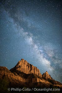
Milky Way over the Watchman, Zion National Park. The Milky Way galaxy rises in the night sky above the the Watchman.
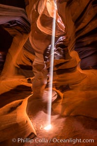
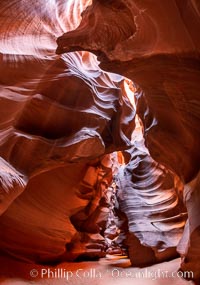
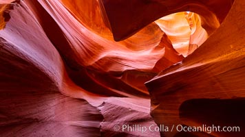
Light Beam in Upper Antelope Slot Canyon. Thin shafts of light briefly penetrate the convoluted narrows of Upper Antelope Slot Canyon, sending piercing beams through the sandstone maze to the sand floor below.
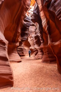
A hiker admiring the striated walls and dramatic light within Antelope Canyon, a deep narrow slot canyon formed by water and wind erosion.
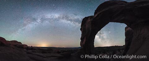
Owachomo Bridge and Milky Way. Owachomo Bridge, a natural stone bridge standing 106' high and spanning 130' wide,stretches across a canyon with the Milky Way crossing the night sky.
A hiker greets the dawn, with Turret Arch in the distance viewed through North Window at Sunrise
The Wave, an area of fantastic eroded sandstone featuring beautiful swirls, wild colors, countless striations, and bizarre shapes set amidst the dramatic surrounding North Coyote Buttes of Arizona and Utah. The sandstone formations of the North Coyote Buttes, including the Wave, date from the Jurassic period. Managed by the Bureau of Land Management, the Wave is located in the Paria Canyon-Vermilion Cliffs Wilderness and is accessible on foot by permit only.
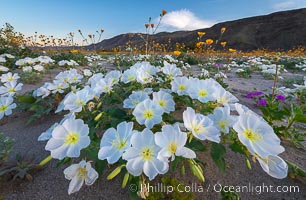
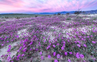
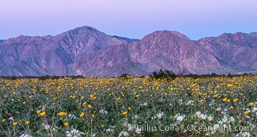
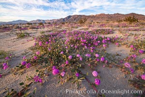
Dune Evening Primrose bloom in Anza Borrego Desert State Park, during the 2017 Superbloom
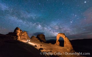
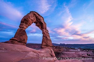
Light Painting Delicate Arch with Stars and the Milky Way
Mesquite Dunes sunrise, dawn, clouds and morning sky, sand dunes.
Panorama of the Milky Way over Mesa Arch.
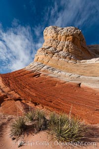
The Second Wave at Sunset, Vermillion Cliffs. The Second Wave, a curiously-shaped sandstone swirl, takes on rich warm tones and dramatic shadowed textures at sunset. Set in the North Coyote Buttes of Arizona and Utah, the Second Wave is characterized by striations revealing layers of sedimentary deposits, a visible historical record depicting eons of submarine geology
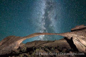
Landscape Arch and Milky Way, Arches National Park, Utah
The Virgin River flows by autumn cottonwood trees, part of the Virgin River Narrows. This is a fantastic hike in fall with the comfortable temperatures, beautiful fall colors and light crowds.
Milky Way at Night over Arch Rock, Joshua Tree National Park
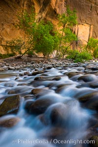
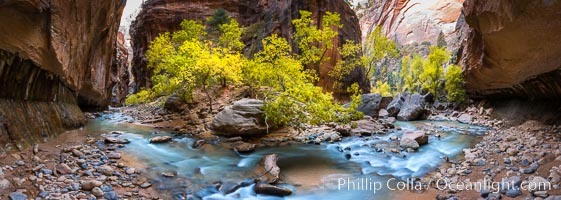
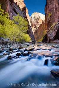
The Virgin River Narrows, where the Virgin River has carved deep, narrow canyons through the Zion National Park sandstone, creating one of the finest hikes in the world.
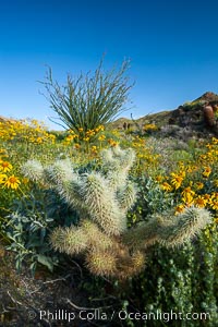
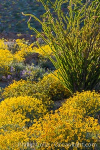
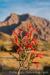
Cholla cactus, brittlebush, ocotillo and various cacti and wildflowers color the sides of Glorietta Canyon. Heavy winter rains led to a historic springtime bloom in 2005, carpeting the entire desert in vegetation and color for months.
Fall Colors in the Virgin River Narrows, Zion National Park, Utah
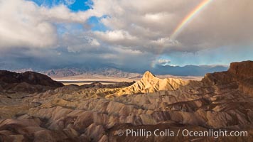
Rainbow and clearing storm clouds, sunrise light on Manly Beacon, Zabriskie Point, Death Valley National Park, California.
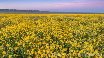
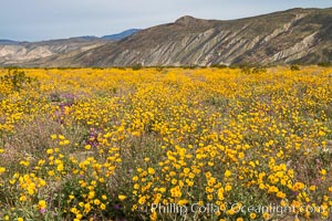
Wildflowers bloom across Carrizo Plains National Monument, during the 2017 Superbloom
Delicate Arch at Sunset, Arches National Park
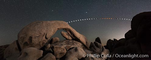
Lunar eclipse sequence and planet Mars over Arch Rock
Milky Way over the Watchman, Zion National Park. The Milky Way galaxy rises in the night sky above the the Watchman.
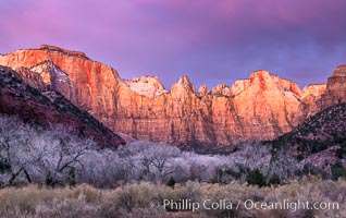
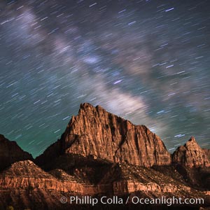
West Temple, The Sundial and the Altar of Sacrifice illuminated by soft alpenglow, about 20 minutes before sunrise.
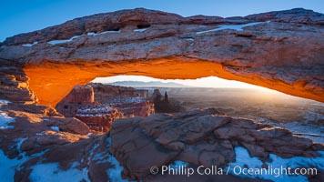
Mesa Arch at Sunrise, Canyonlands National Park, Utah
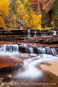
Archangel Falls in autumn, near the Subway in North Creek Canyon, with maples and cottonwoods turning fall colors.
Dawn over the Skyline Rim, Factory Bench and Lower Blue Hills, Utah. The Henry Mountains are in the distance.
Milky Way and Stars over Broken Arch, Arches National Park, Utah
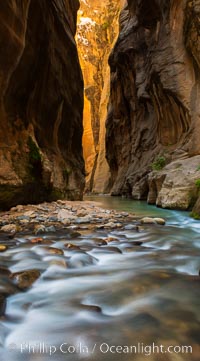
The Virgin River Narrows, where the Virgin River has carved deep, narrow canyons through the Zion National Park sandstone, creating one of the finest hikes in the world.
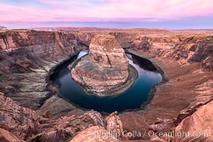
Spectacular Horseshoe Bend sunrise. The Colorado River makes a 180-degree turn at Horseshoe Bend. Here the river has eroded the Navajo sandstone for eons, digging a canyon 1100-feet deep
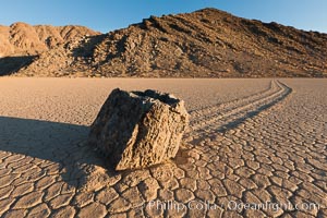
Sailing stone on the Racetrack Playa. The sliding rocks, or sailing stones, move across the mud flats of the Racetrack Playa, leaving trails behind in the mud. The explanation for their movement is not known with certainty, but many believe wind pushes the rocks over wet and perhaps icy mud in winter
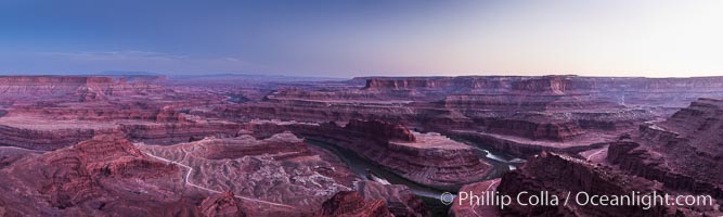
Sunset at Dead Horse Point Overlook, with the Colorado River flowing 2,000 feet below. 300 million years of erosion has carved the expansive canyons, cliffs and walls below and surrounding Deadhorse Point
Brittlebush blooms in spring, Palm Canyon, Anza Borrego Desert State Park.
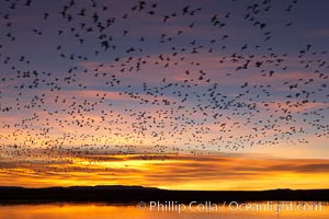
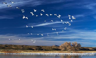
Snow geese at dawn. Snow geese often ""blast off"" just before or after dawn, leaving the ponds where they rest for the night to forage elsewhere during the day.
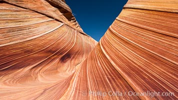
Sandstone swirls at The Wave, North Coyote Buttes.
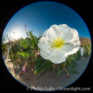
Dune Evening Primrose bloom in Anza Borrego Desert State Park
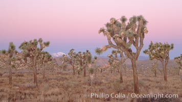
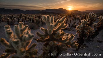
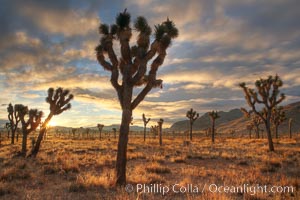
Joshua Trees at dawn, Yucca brevifolia, Joshua Tree National Park.
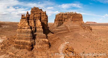
Molly's Castle, aerial view, Goblin Valley State Park. Curtis Formation whiteish caprock is on top, with reddish Entrada Sandstone below, both of Jurassic era. Molly's castle lies in the San Rafael desert near Goblin Valley, and drains into the Colorado River watershed. Aerial panoramic photograph.
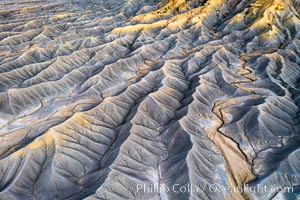
Erosion patterns in the Utah Badlands, aerial abstract photo.
Fantastic colorful sedimentary patterns of Bentonite layers, seen as striations exposed in the Utah Badlands. The Bentonite Hills are composed of the Brushy Basin shale member of the Morrison Formation formed during Jurassic times when mud, silt, fine sand, and volcanic ash were deposited in swamps and lakes into layers, now revealed through erosion. Aerial photograph.
Self-portrait at dawn, Bentonite Hills, Utah
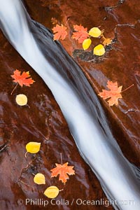
Water rushes through a narrow crack, in the red sandstone of Zion National Park, with fallen autumn leaves.
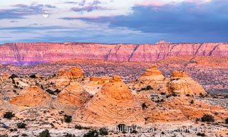
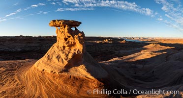
Teepee rocks at sunrise with the Vermillion Cliffs in the distance
Sand verbena wildflowers on sand dunes, Anza-Borrego Desert State Park
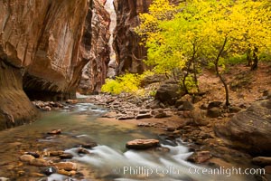
The Virgin River flows by autumn cottonwood trees, part of the Virgin River Narrows. This is a fantastic hike in fall with the comfortable temperatures, beautiful fall colors and light crowds.
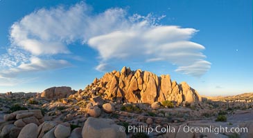
Sunset and boulders, Joshua Tree National Park, panorama.
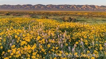
Wildflowers bloom across Carrizo Plains National Monument, during the 2017 Superbloom
Sunrise in Joshua Tree National Park.
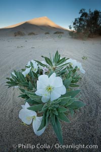
Eureka Valley Dune Evening Primrose. A federally endangered plant, Oenothera californica eurekensis is a perennial herb that produces white flowers from April to June. These flowers turn red as they age. The Eureka Dunes evening-primrose is found only in the southern portion of Eureka Valley Sand Dunes system in Indigo County, California.
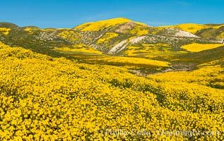
Wildflowers bloom across Carrizo Plains National Monument, during the 2017 Superbloom
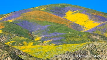
Wildflowers bloom across Carrizo Plains National Monument, during the 2017 Superbloom

Full moon with 22-degree lunar halo, Joshua Tree National Park. The lunar halo (not to be cofused with lunar corona) forms when moonlight refracts through high altitude ice crystals. As no light is refracted at angles smaller than 22-degrees the sky is darker inside the halo.
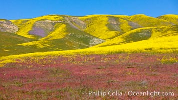
Wildflowers bloom across Carrizo Plains National Monument, during the 2017 Superbloom
Sunset on the Last Chance Mountain Range, seen from Eureka Valley Sand Dunes.
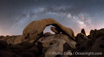
Milky Way during Full Lunar Eclipse over Arch Rock, Joshua Tree National Park, April 4 2015. The arch and surrounding landscape are illuminated by the faint light of the fully-eclipsed blood red moon. Light from the sun has passed obliquely through the Earth's thin atmosphere, taking on a red color, and is then reflected off the moon and reaches the Earth again to light the arch. The intensity of this light is so faint that the Milky Way can be seen clearly at the same time.
Milky Way and Stars over Broken Arch, Arches National Park, Utah
Slot canyons are formed when water and wind erode a cut through a (usually sandstone) mesa. Lower Antelope Canyon, Arizona.
Radio Tower Rock at Sunset, Page, Arizona
Dawn breaks over the Bentonite Hills in the Utah Badlands. Striations in soil reveal layers of the Morrison Formation, formed in swamps and lakes in the Jurassic era. Aerial panoramic photograph.
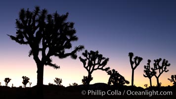
Joshua Trees silhouetted against predawn sunrise light.
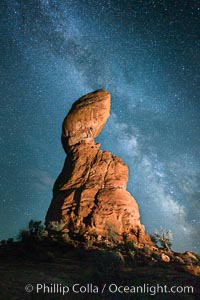
Balanced Rock and Milky Way stars at night.
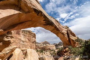
Hickman Bridge, Capitol Reef National Park
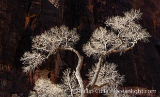
Fremont Cottonwood Tree in winter sillhouette against red Zion Canyon walls
Snow geese at dawn. Snow geese often ""blast off"" just before or after dawn, leaving the ponds where they rest for the night to forage elsewhere during the day.
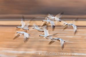
Snow geese in flight, wings are blurred in long time exposure as they are flying.
Boulders and sunset in Joshua Tree National Park. The warm sunlight gently lights unusual boulder formations at Jumbo Rocks in Joshua Tree National Park, California.
Brittlebush bloom in Anza Borrego Desert State Park, during the 2017 Superbloom
Dune Evening Primrose bloom in Anza Borrego Desert State Park, during the 2017 Superbloom
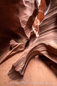
Rattlesnake Canyon, a beautiful slot canyon that is part of the larger Antelope Canyon system. Page, Arizona.
Belt of Venus over Grand Canyon at sunrise, viewed from Hopi Point on the south rim of Grand Canyon National Park. The Belt of Venus, or anti-twilight arch, is the shadow of the earth cast upon the atmosphere just above the horizon, and occurs a few minutes before sunrise or after sunset.
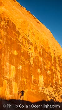
Rising sun creates the photographers shadow on a sandstone wall.
Yellow cottonwood trees in autumn, fall colors in the Virgin River Narrows in Zion National Park.
Sunset over Garden of the Gods, Arches National Park
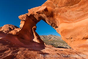
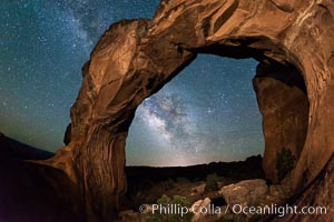
Natural arch formed in sandstone.
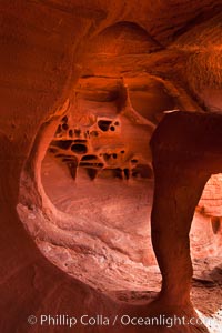
Fire Arch or Windstone Arch, also known as Fire Cave, is a tiny cave with a miniature arch and a group of natural pocket holes. Many people walk by this cave without realizing it is there!
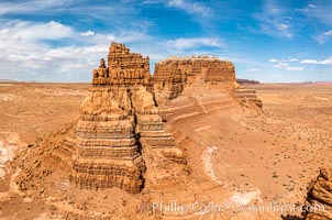
Molly's Castle, aerial view, Goblin Valley State Park
The Organ at sunrise, Courthouse Towers, Arches National Park
Upper Antelope Canyon, a deep, narrow and spectacular slot canyon lying on Navajo Tribal lands near Page, Arizona
Brittlebush bloom in Anza Borrego Desert State Park, during the 2017 Superbloom
Parry's Nolina, Nolina parryi, Joshua Tree National Park.
Desert Sunflower Blooming Across Anza Borrego Desert State Park
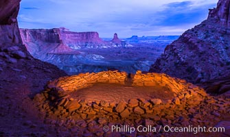
False Kiva at Sunset, Canyonlands National Park, Utah
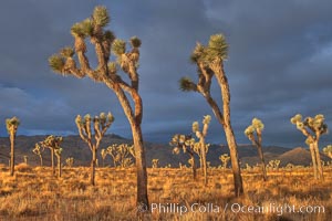
Sunrise in Joshua Tree National Park, Yucca brevifolia.
Wildflowers bloom in Anza Borrego Desert State Park, during the 2017 Superbloom
Wildflowers bloom in Anza Borrego Desert State Park, during the 2017 Superbloom
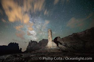
Stone columns rising in the night sky, milky way and stars and clouds filling the night sky overhead.
Soda Springs Basin from Green River Overlook, Island in the Sky, Canyonlands National Park, Utah.
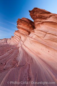
The Great Wall, Navajo Tribal Lands, Arizona. Sandstone ""fins"", eroded striations that depict how sandstone -- ancient compressed sand -- was laid down in layers over time. Now exposed, the layer erode at different rates, forming delicate ""fins"" that stretch for long distances.
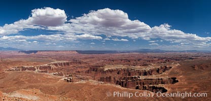
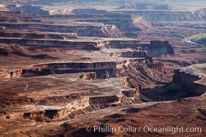
Canyonlands National Park panorama.
Full Moon over the Fire Wave
Sand verbena wildflowers on sand dunes, Anza-Borrego Desert State Park
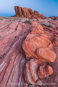
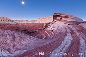
Sunrise lights sandstone rocks, Valley of Fire
Erosion patterns in the Utah Badlands, aerial abstract photo.
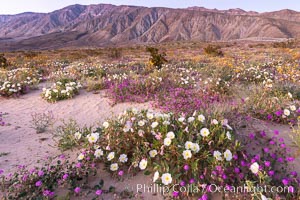
Dune primrose (white) and sand verbena (purple) bloom in spring in Anza Borrego Desert State Park, mixing in a rich display of desert color
The Wave, an area of fantastic eroded sandstone featuring beautiful swirls, wild colors, countless striations, and bizarre shapes set amidst the dramatic surrounding North Coyote Buttes of Arizona and Utah. The sandstone formations of the North Coyote Buttes, including the Wave, date from the Jurassic period. Managed by the Bureau of Land Management, the Wave is located in the Paria Canyon-Vermilion Cliffs Wilderness and is accessible on foot by permit only.
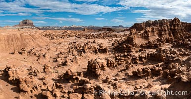
Hoodoos in Goblin Valley State Park, aerial panorama. The ""goblins"" are technically known as hoodoos, formed through the gradual erosion of Entrada sandstone deposited 170 millions years ago. Aerial panoramic photograph.
Sunrise lights sandstone rocks, Valley of Fire
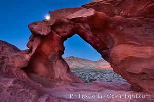
Natural arch formed in sandstone frames the setting moon.
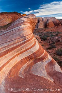
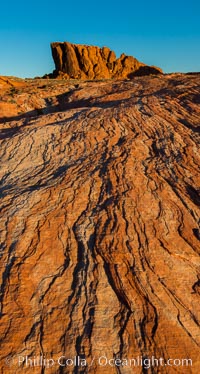
The Fire Wave, a beautiful sandstone formation exhibiting dramatic striations, striped layers in the geologic historical record.
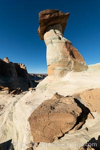
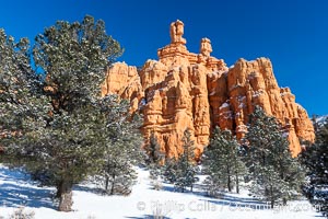
Pedestal rock, or hoodoo, at Stud Horse Point. These hoodoos form when erosion occurs around but not underneath a more resistant caprock that sits atop of the hoodoo spire. Stud Horse Point is a spectacular viewpoint on a mesa overlooking the Arizona / Utah border.
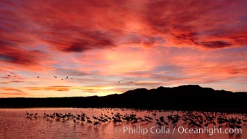
Sunset at Bosque del Apache National Wildlife Refuge, with sandhill cranes silhouetted in reflection in the calm pond. Spectacular sunsets at Bosque del Apache, rich in reds, oranges, yellows and purples, make for striking reflections of the thousands of cranes and geese found in the refuge each winter.
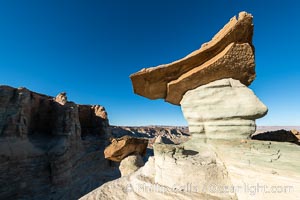
Pedestal rock, or hoodoo, at Stud Horse Point. These hoodoos form when erosion occurs around but not underneath a more resistant caprock that sits atop of the hoodoo spire. Stud Horse Point is a spectacular viewpoint on a mesa overlooking the Arizona / Utah border.
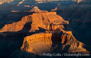
Grand Canyon at dusk, sunset, viewed from Grandeur Point on the south rim of Grand Canyon National Park
Lower Antelope Canyon, a deep, narrow and spectacular slot canyon lying on Navajo Tribal lands near Page, Arizona
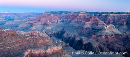
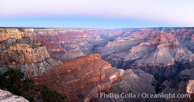
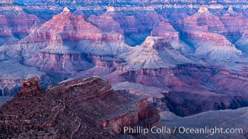
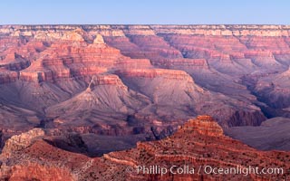
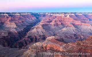
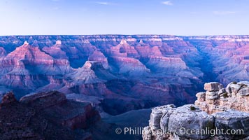
Grand Canyon at sunrise viewed from Yavapai Point on the south rim of Grand Canyon National Park
Grand Canyon at dusk, sunset, viewed from Mather Point on the south rim of Grand Canyon National Park
Belt of Venus over Grand Canyon at dusk, sunset, viewed from Mather Point on the south rim of Grand Canyon National Park. The Belt of Venus, or anti-twilight arch, is the shadow of the earth cast upon the atmosphere just above the horizon, and occurs a few minutes before sunrise or after sunset.
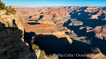
Grand Canyon at sunrise viewed from Yavapai Point on the south rim of Grand Canyon National Park
The Great Wall. Sunset on sandstone fins, Navajo Tribal Lands, Arizona.
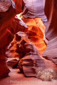
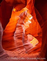
Fantastic light in Upper Antelope Slot Canyon, Arizona.
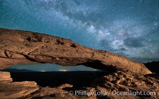
The Milky Way arching over Mesa Arch at night.
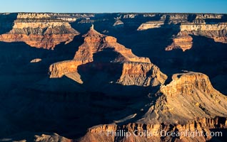
Grand Canyon at sunrise viewed from Yavapai Point on the south rim of Grand Canyon National Park
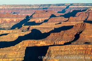
Grand Canyon at sunrise viewed from Yavapai Point on the south rim of Grand Canyon National Park
Grand Canyon at sunrise, viewed from Hopi Point on the south rim of Grand Canyon National Park
Grand Canyon at dusk, sunset, viewed from Grandeur Point on the south rim of Grand Canyon National Park
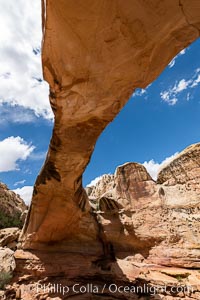
Hickman Bridge, Capitol Reef National Park
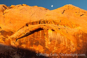
Setting moon over natural sandstone arch, sunrise.
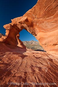
Natural arch formed in sandstone.
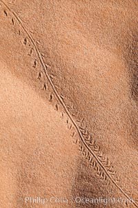
Animal tracks in sand.

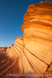
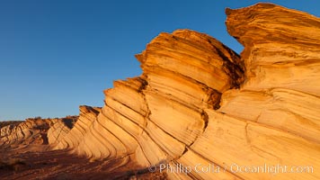
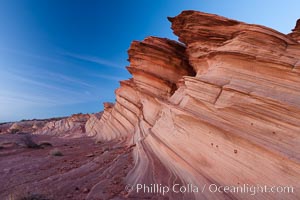
Striated sandstone formations, layers showing eons of geologic history.
Snow geese, and one of the ""crane pools"" in the northern part of Bosque del Apache NWR.
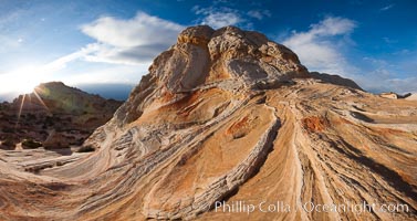
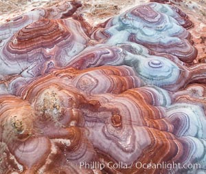
Sarah's Swirl, a particularly beautiful formation at White Pocket in the Vermillion Cliffs National Monument.
The Lollipop, White Pocket, Vermilion Cliffs National Monument.
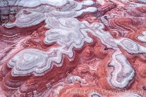
Brain rocks and clouds, White Pocket, Vermillion Cliffs National Monument, Arizona.
The Great Wall, Navajo Tribal Lands, Arizona
Hoodoo goblin rocks at dawn.
Sandstone ""fins"", eroded striations that depict how sandstone -- ancient compressed sand -- was laid down in layers over time. Now exposed, the layer erode at different rates, forming delicate ""fins"" that stretch for long distances.
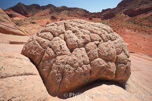
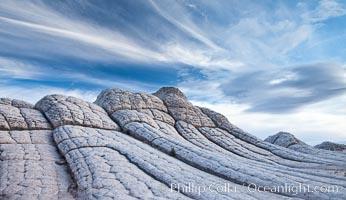
Brain rocks. Sandstone is curiously eroded through the forces water and wind acting over eons. Cracks and joints arise when water freezes and expands repeatedly, braking apart the soft sandstone.
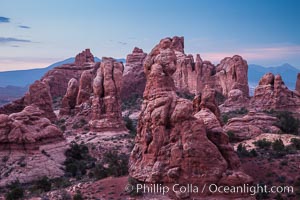
Hoodoos, walls and sandstone spires.